After our Utah trip the weekend prior, we couldn’t wait to get back to the mountains and woodsy terrain of Colorado for the upcoming, extended Fourth of July weekend. Little did we know how much we would miss the quiet and uncrowded trails of Utah compared to the stunning, but busy trails of Colorado.
Although we had already done the infamous Alpine Loop outside Silverton/Lake City in mid-June as our inaugural ride in our new Jeep, we wanted to revisit the Alpine Loop during a 3-day weekend when we would have more time to try other backcountry roads nearby, specifically Ophir Pass and Imogene Pass.
Feeling brave after some encouraging support and nudging from Pie, I actually decided to drive the first half of Cinnamon Pass on the Alpine Loop.

After reaching the top of Cinnamon Pass and having driven approximately 24 of the slowest, most nerve-racking miles I had ever driven, I insisted hubby take over again because I knew it was (literally) steep downhill from there. We were never going to reach our destination with me behind the wheel freaking out at every bump in the road… or 50-foot drop-off beside the road, for that matter! I wish I could say it was fun while it lasted, but driving the rough backcountry roads was definitely better left in Pie’s hands.
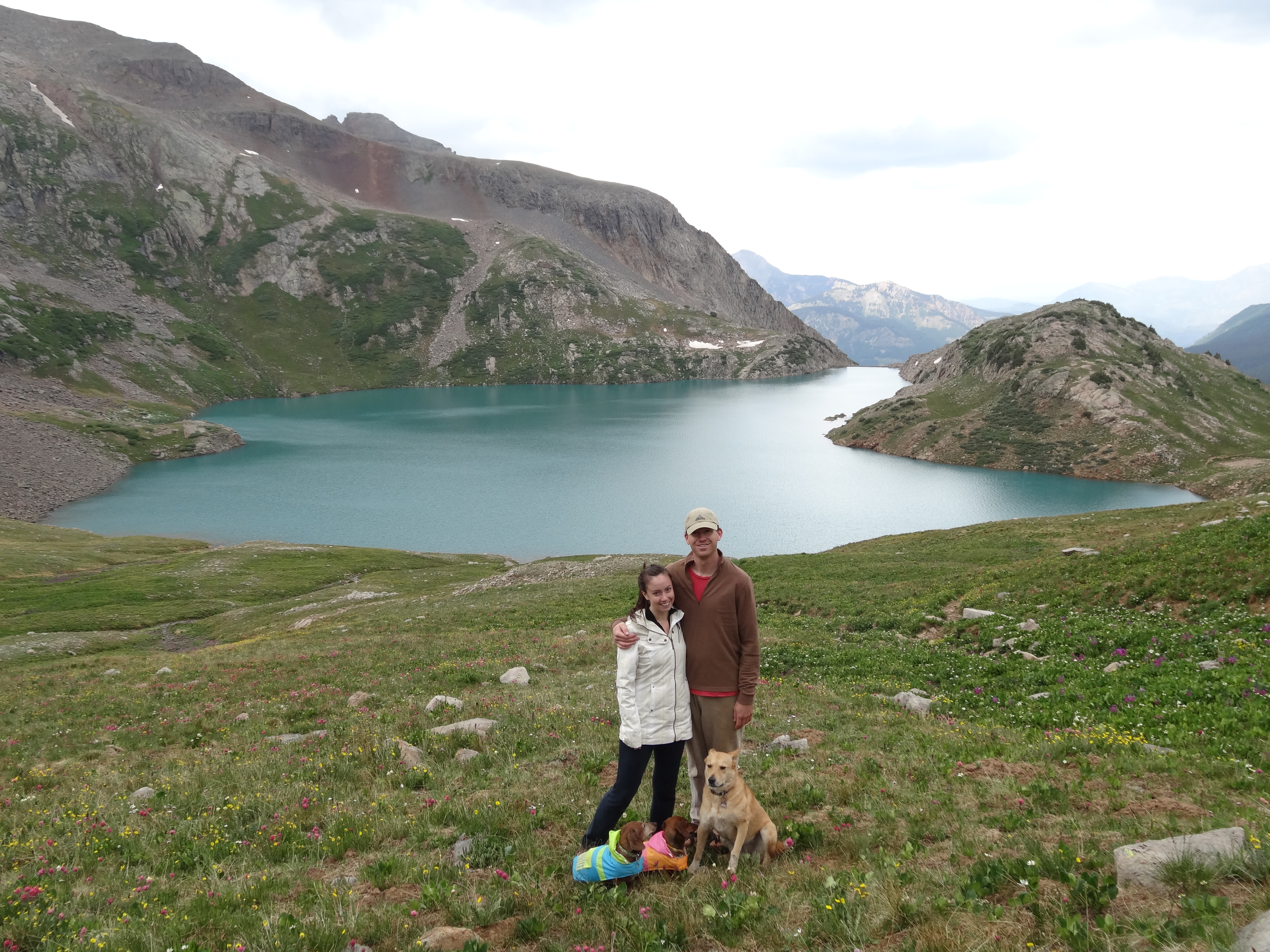
Besides, shotgun was the place to be for admiring views, especially since I was trying to keep an eye out for a specific spot along the road where I could recreate a photo I had taken with Banana during our very first trip in 2011. I had wrongly assumed that the backdrop would be obvious to spot during our drive and hadn’t saved the photo to my phone for reference. During our previous mid-June trip, there had been too much snow left to figure out where the spot was, but with the terrain having changed so much from the avalanche debris from the 2018-2019 season, it was still tough to recognize the exact spot. Despite relying on our memory to find the specific backdrop, we actually came impressively close! Interestingly too, was that we unintentionally recreated the photo exactly nine years later, to the day.


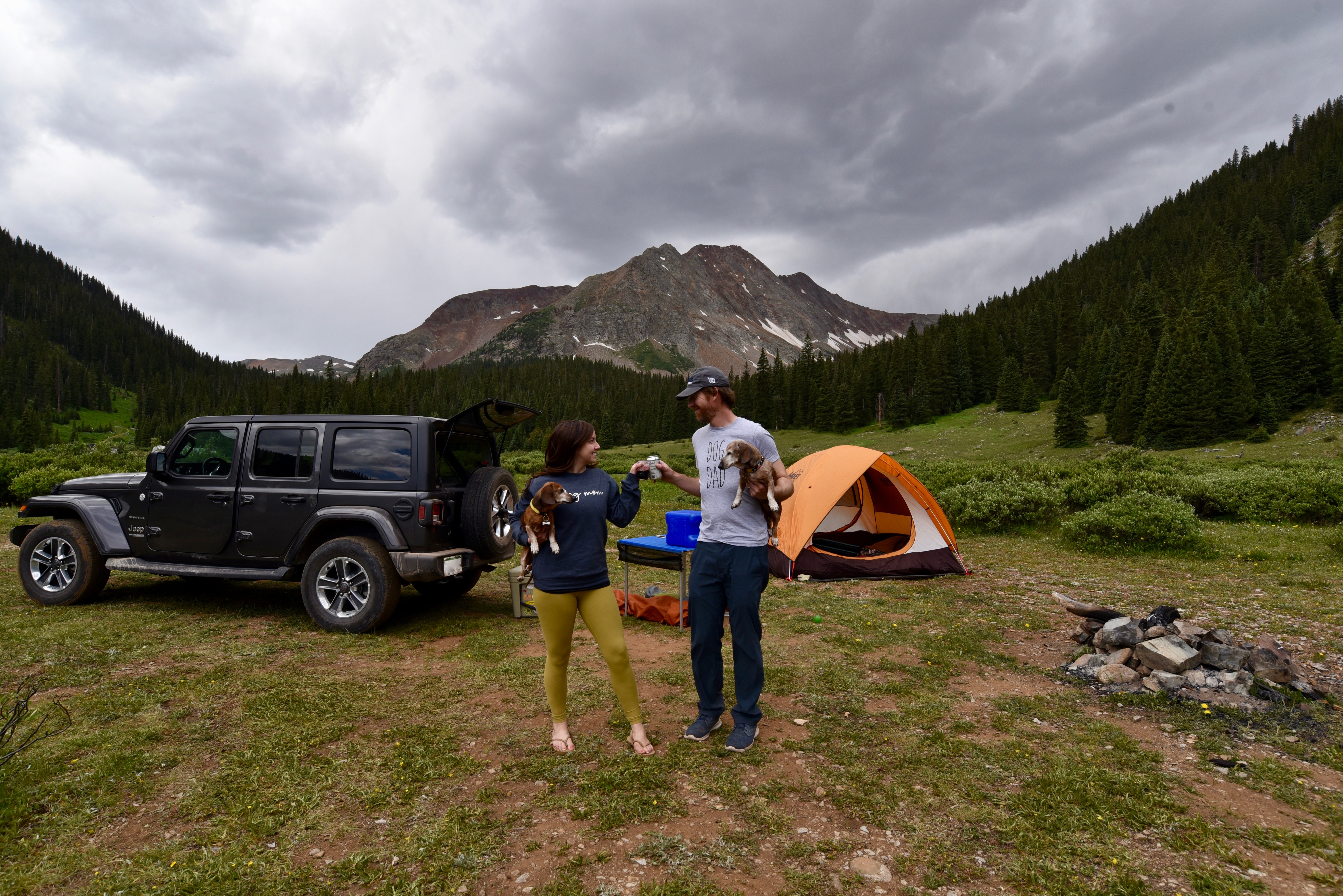
After completing Cinnamon Pass, we headed to our usual, favorite camping area outside Silverton, only to find that it was packed to the brim with campers for the holiday weekend. We pouted and eventually came to terms with the fact that we wouldn’t have a quiet, secluded spot for camping, so we settled for an area with just enough distance away from other campers nearby to pretend we were in the woods by ourselves.
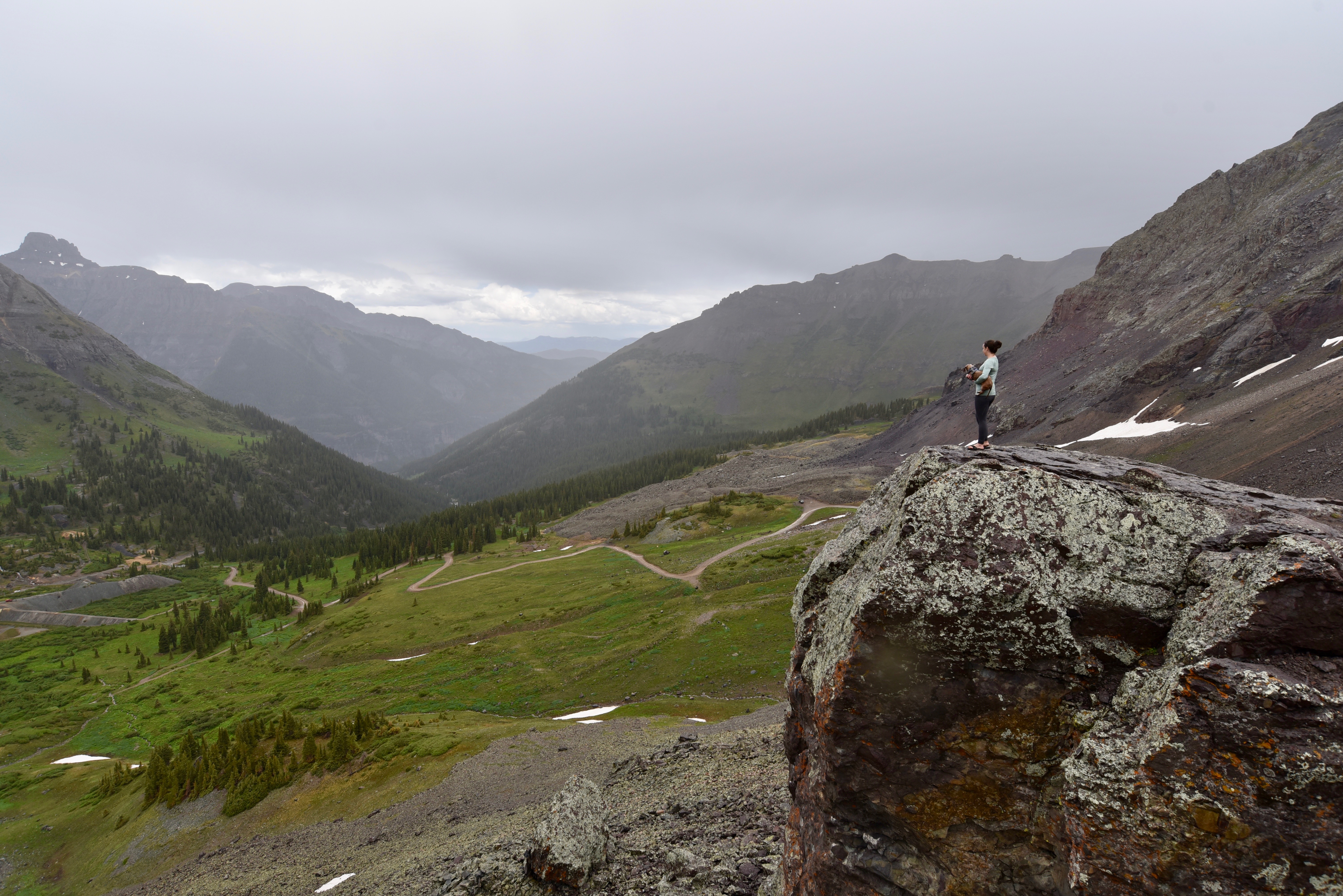
It was early-afternoon by the time we set up camp and we had plenty of time left for a hike, but dark clouds blanketed the sky above the mountain in the direction we wanted to head. Afternoon mountain storms in Colorado are no joke and lightning is a real threat, but we decided to chance it. If the weather conditions increased in severity as we got above tree-line, we would just retreat back to our camp.

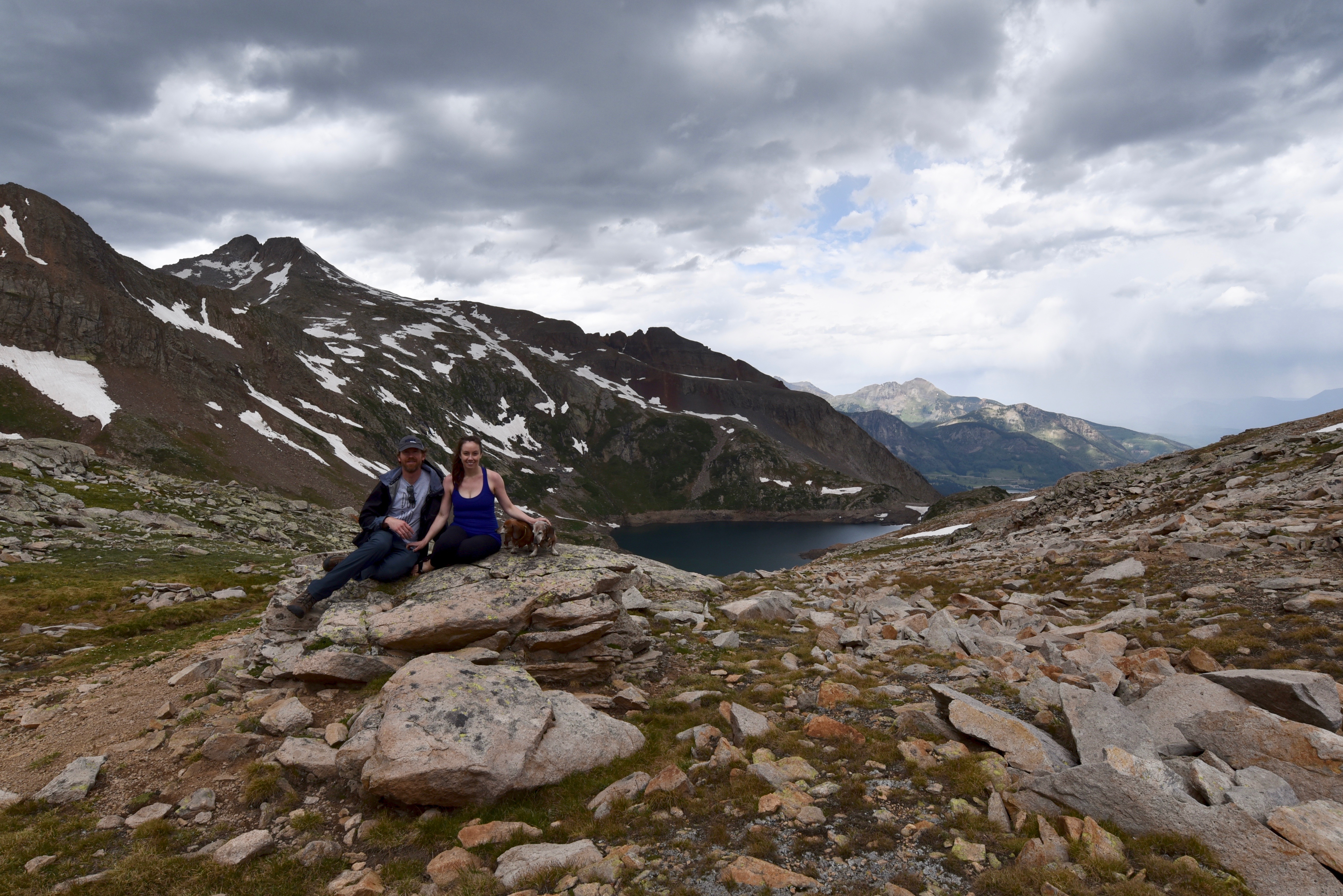
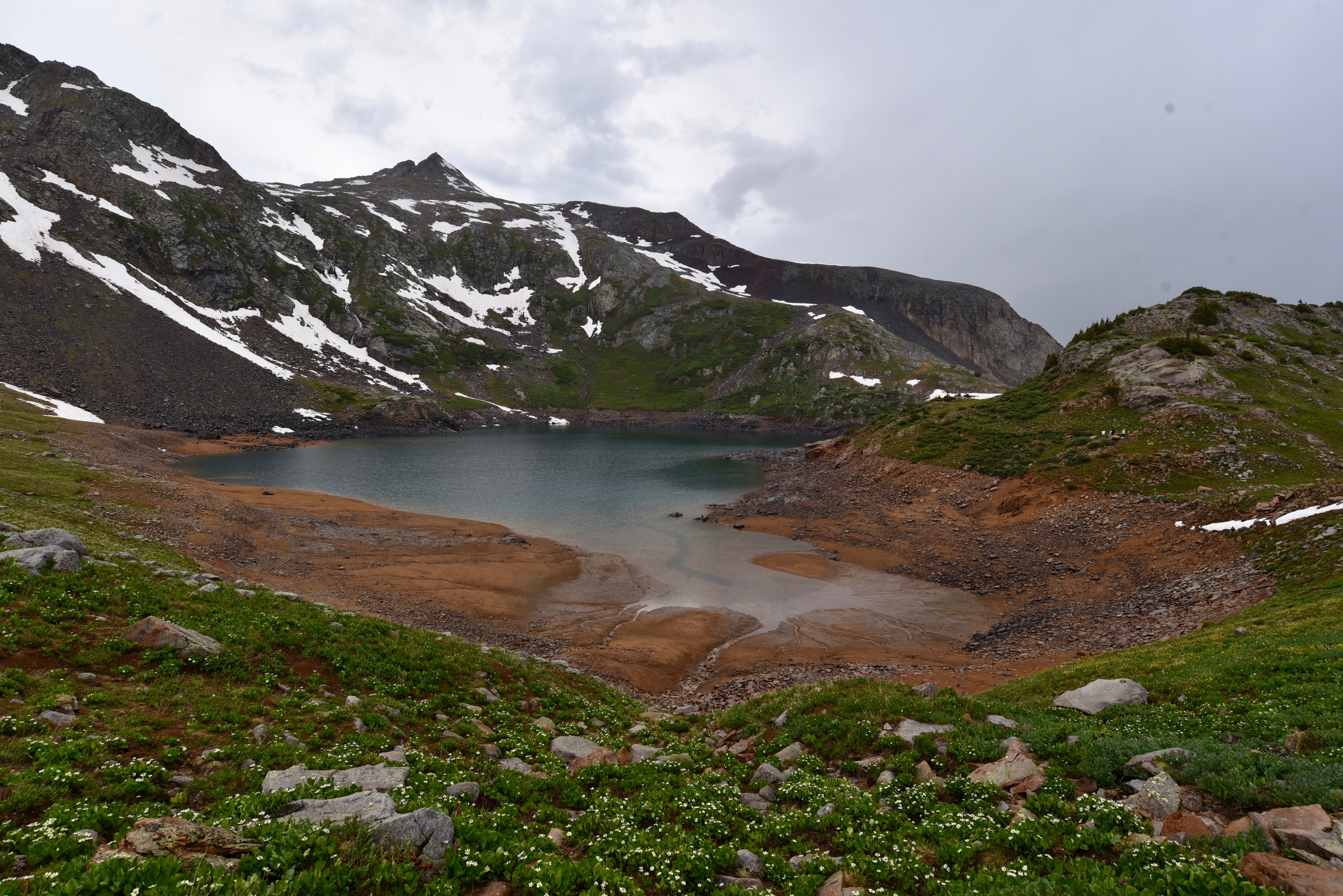
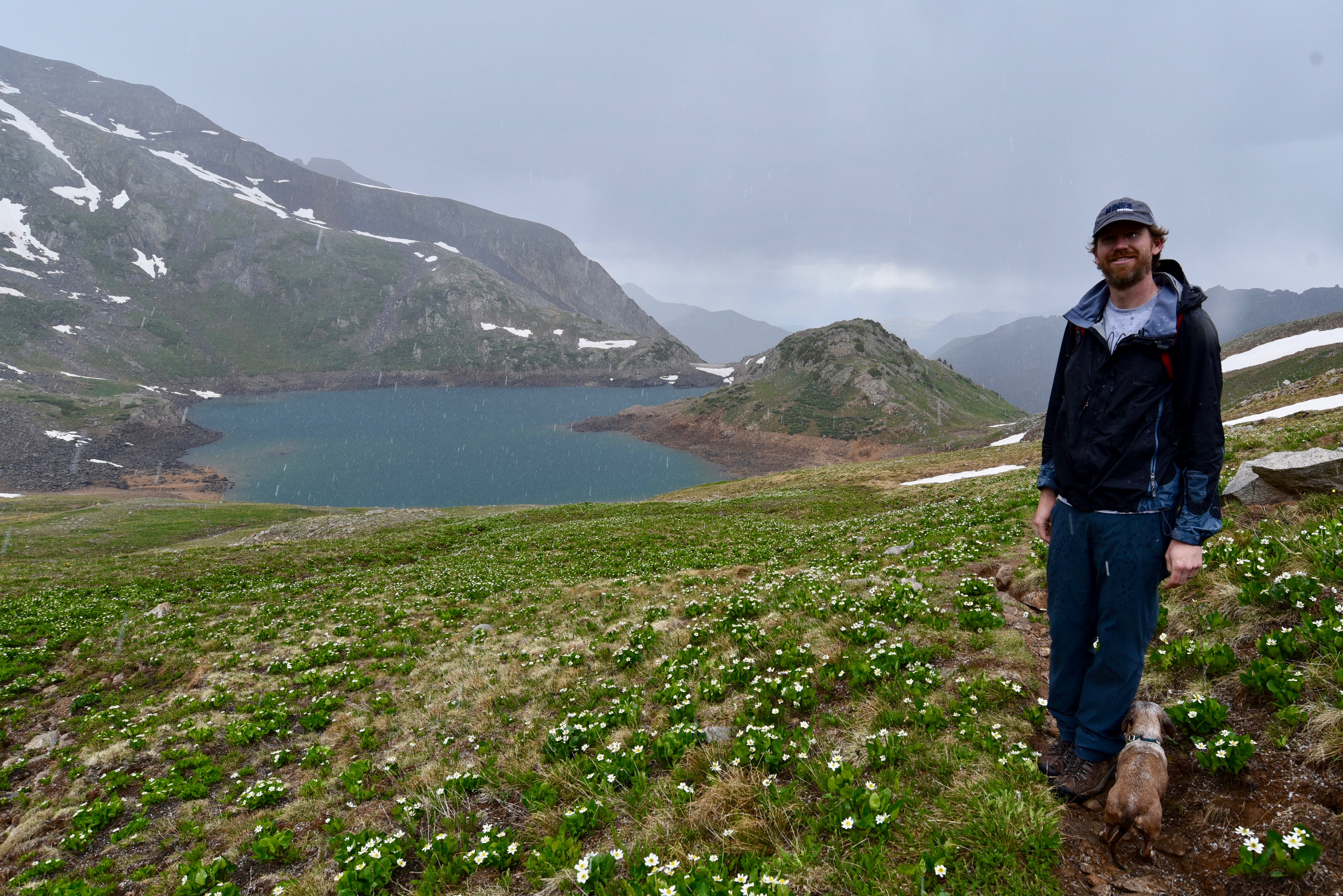
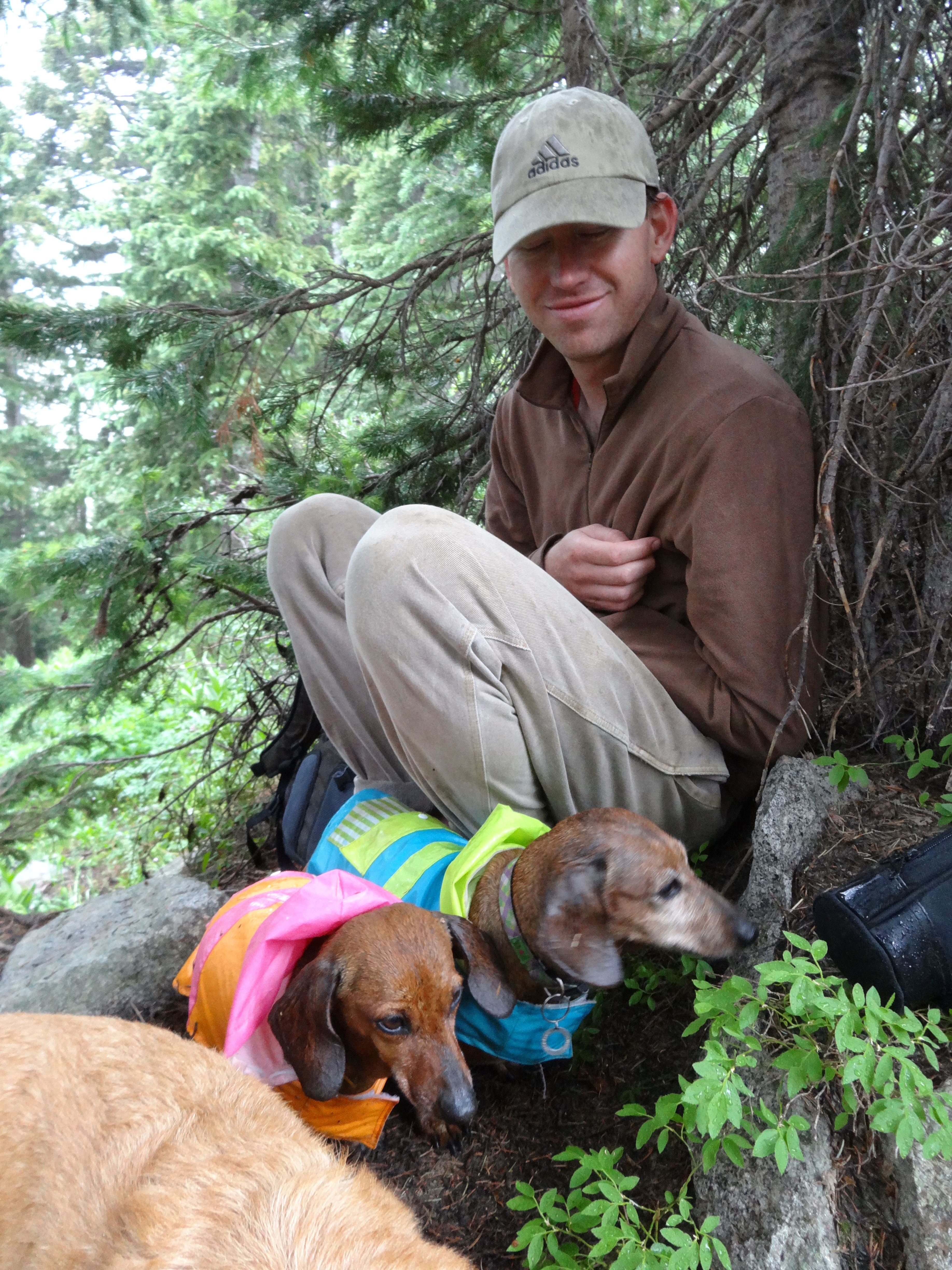
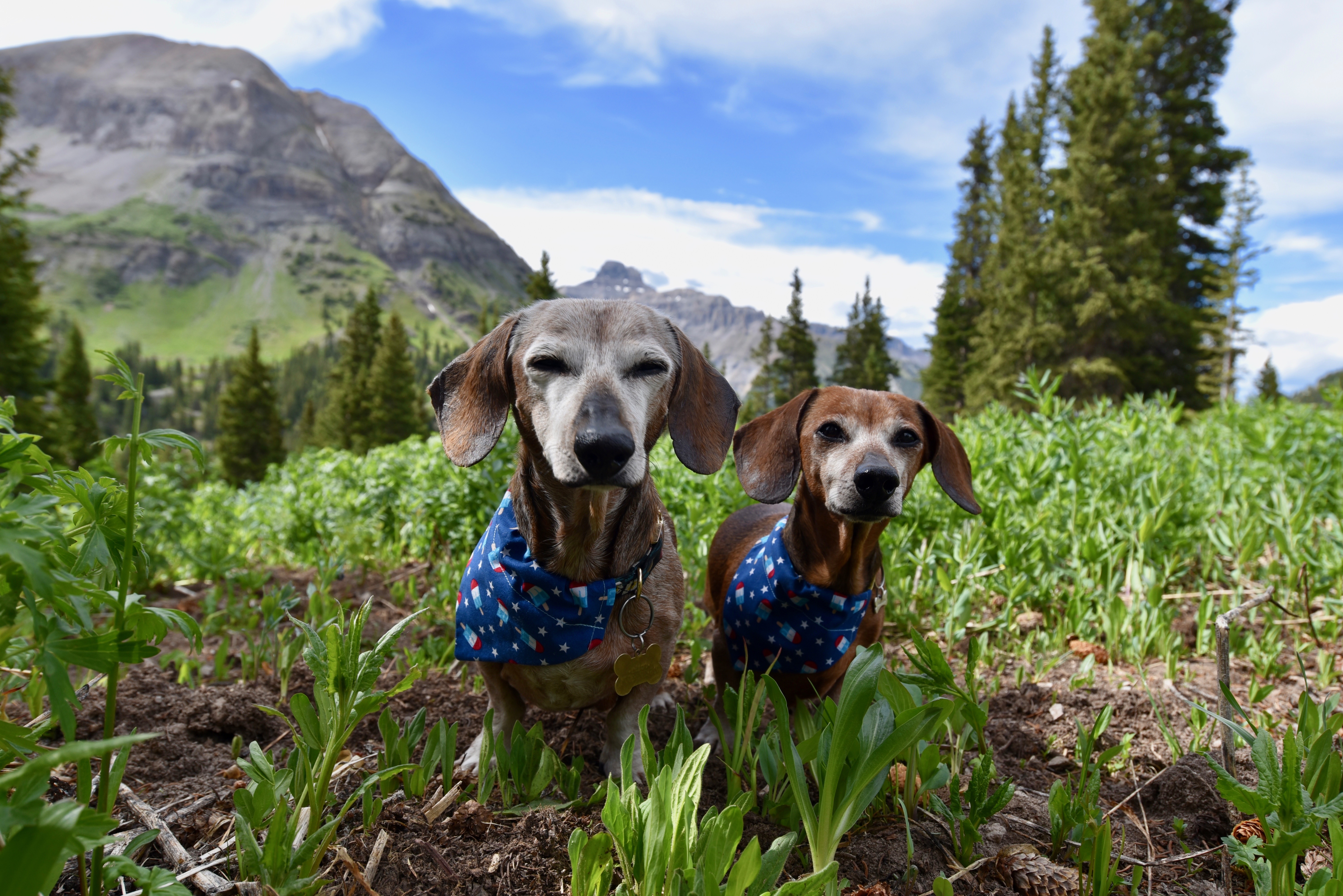
We ended up making it to our destination, a beautiful blue lake, but not without enduring a quick storm with freezing rain and sleet. The dachs were certainly less than thrilled with our decision to do this hike, but we still had a good time and good laugh that this was the second time that this exact same scenario of less-than-deal weather had bamboozled our hike to this lake.


What was way more disappointing than the weather was that we returned to camp to find a huge crew had set up camp just a few feet away from us. We had been so excited to return back after our long, six-hour hike and enjoy happy hour at our camp, but this put a damper on our moods. Between this new camp that was blasting music and another camp nearby with a bunch of kids running around needlessly plucking up beautiful plants from the ground, we had almost been tempted to just pack up and leave that very night! We stuck it out and tried to move our tent as far away as possible from this new camp, but it didn’t make much of a difference.
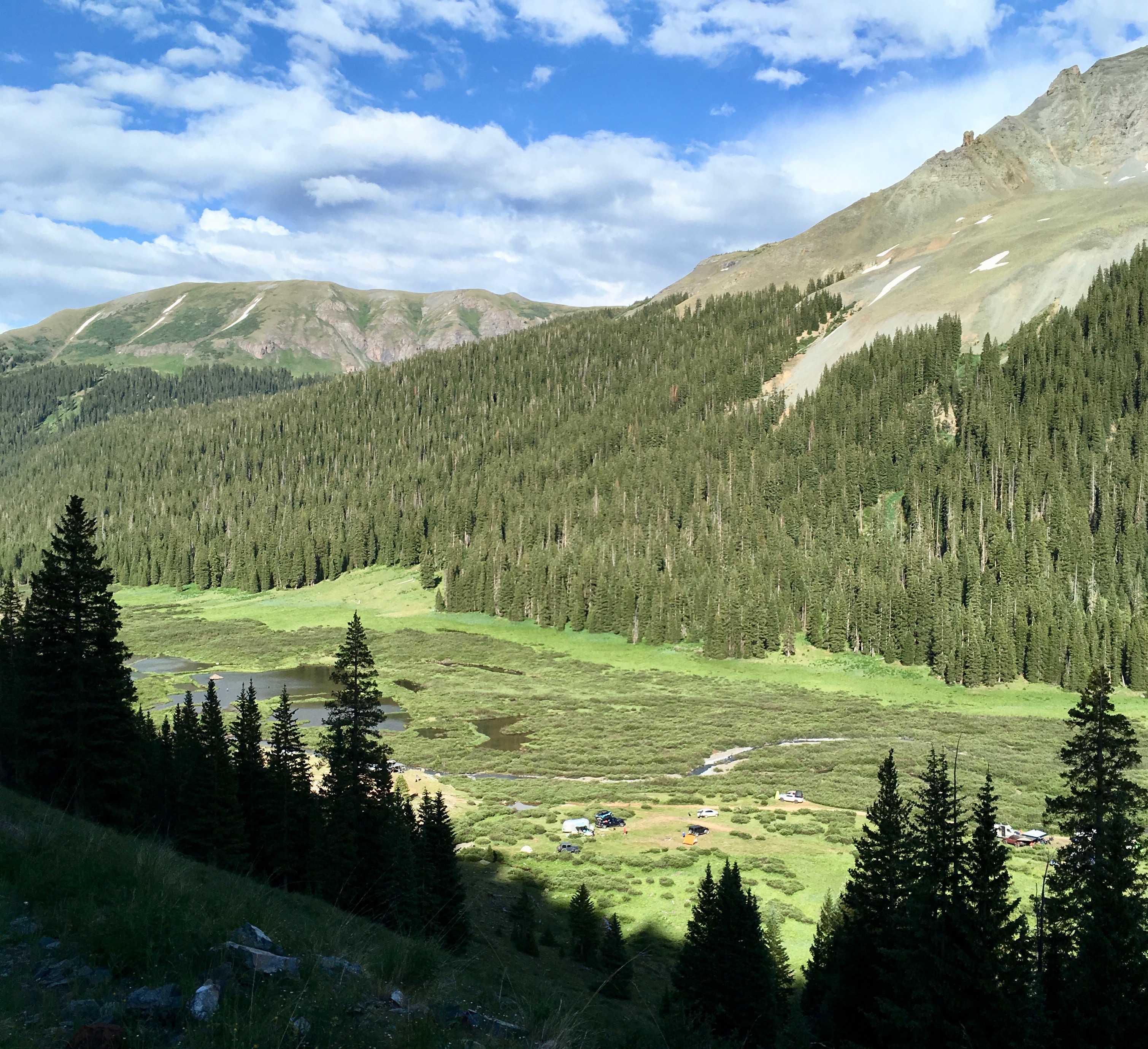

If we thought that things couldn’t get any more annoying, we were certainly tempting the Universe. At 11 P.M. that night, yet another set of campers arrived, with their headlights shining directly in our tent from a mere 10 feet away. They ended up setting up camp just a few feet away from us. We had never experienced a more frustrating situation while camping!
Needless to say, we packed up extra early the next morning at 6 A.M. and got the heck out of there. We had originally wanted to stay two nights at the same campsite because we didn’t want to try to find a new campsite in the middle of a busy holiday weekend, but there was no way we could handle another night at that unpeaceful spot.
Our plan for this next day was to take Ophir Pass from Silverton to Ophir; drive north from Ophir up to Telluride; then take Imogene Pass from Telluride to Ouray. As usual, we would just wing our camping plans; if we found something along the way while driving these passes, great! If not, we would start heading back towards Denver from Ouray and find somewhere along the way to camp.
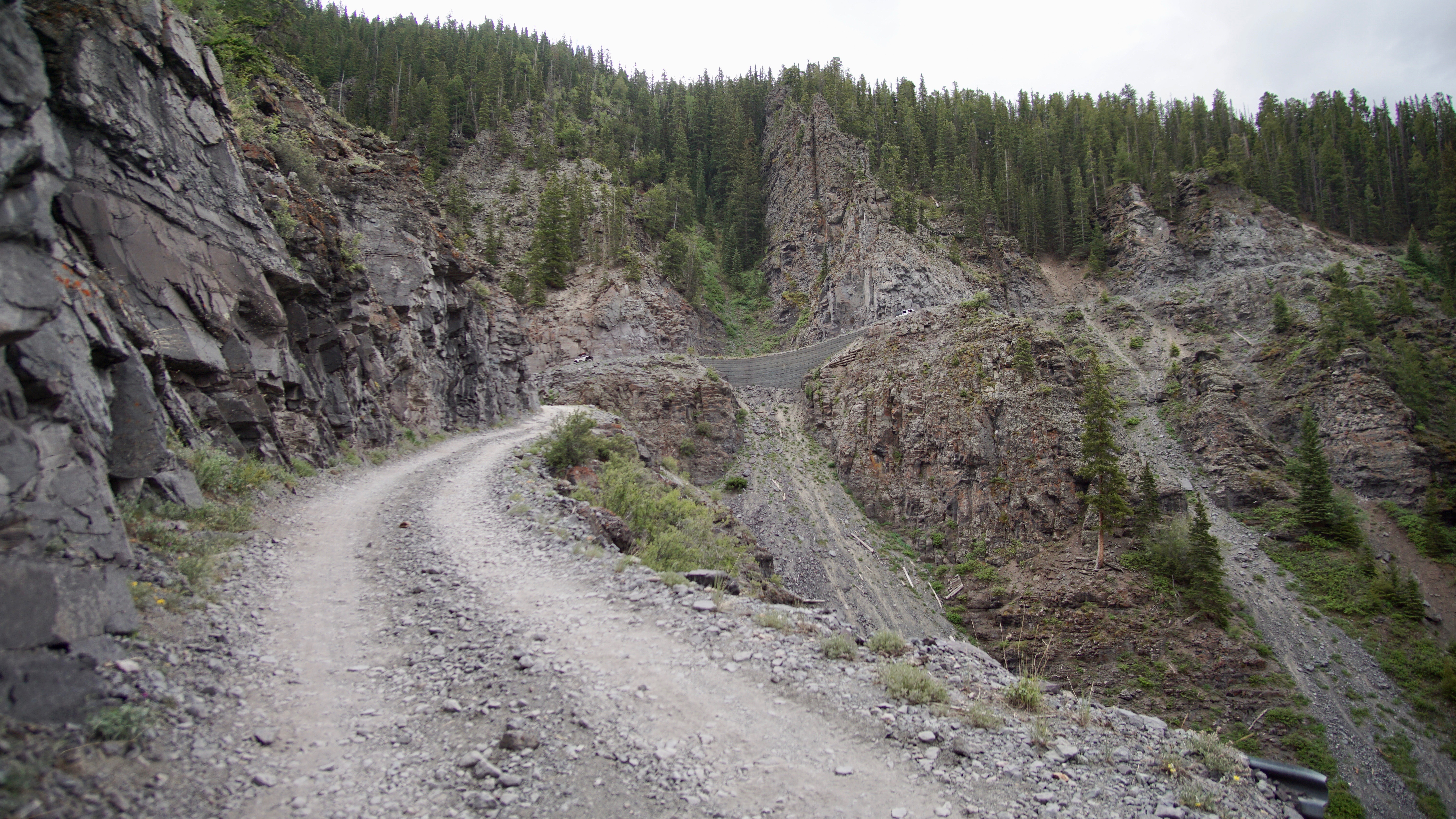
From all reports, Ophir Pass was supposed to be a relatively easy, non-technical road that even novices could do, so I was relieved that we would finally be driving something more tame. The section from Silverton to the top of Ophir Pass was indeed straightforward and laid back; however, the top of Ophir Pass down to the town of Ophir was quite an experience! The road was extremely bumpy with huge, pointy rocks on a mile-long shelf road with room enough for just one vehicle. Although the start of this bumpy, narrow shelf road has a good view to see if someone is starting the road from the opposite end, I cringed at the thought of someone stubbornly deciding to proceed on the other end of the road even though we had started on it first. It would be one heck of a tight and scary squeeze for two vehicles to pass or an annoying and unnecessary back-track for one of the vehicles. Thankfully, no other vehicle showed up while we were on this nerve-racking section and the unique colors of the rock on the mountainside and views on this side of the pass were distracting enough to get me through the drive with only a few panic attacks.


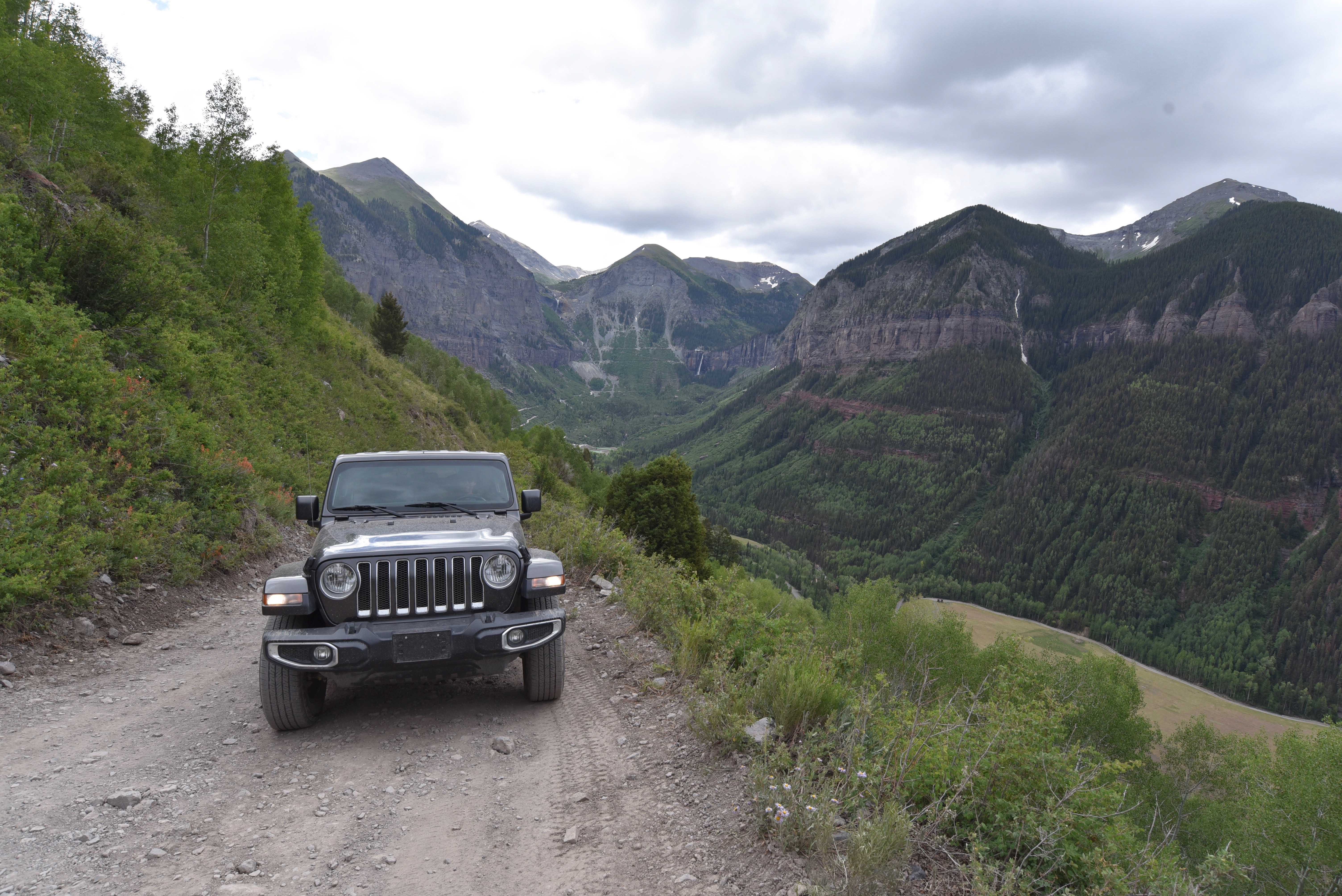
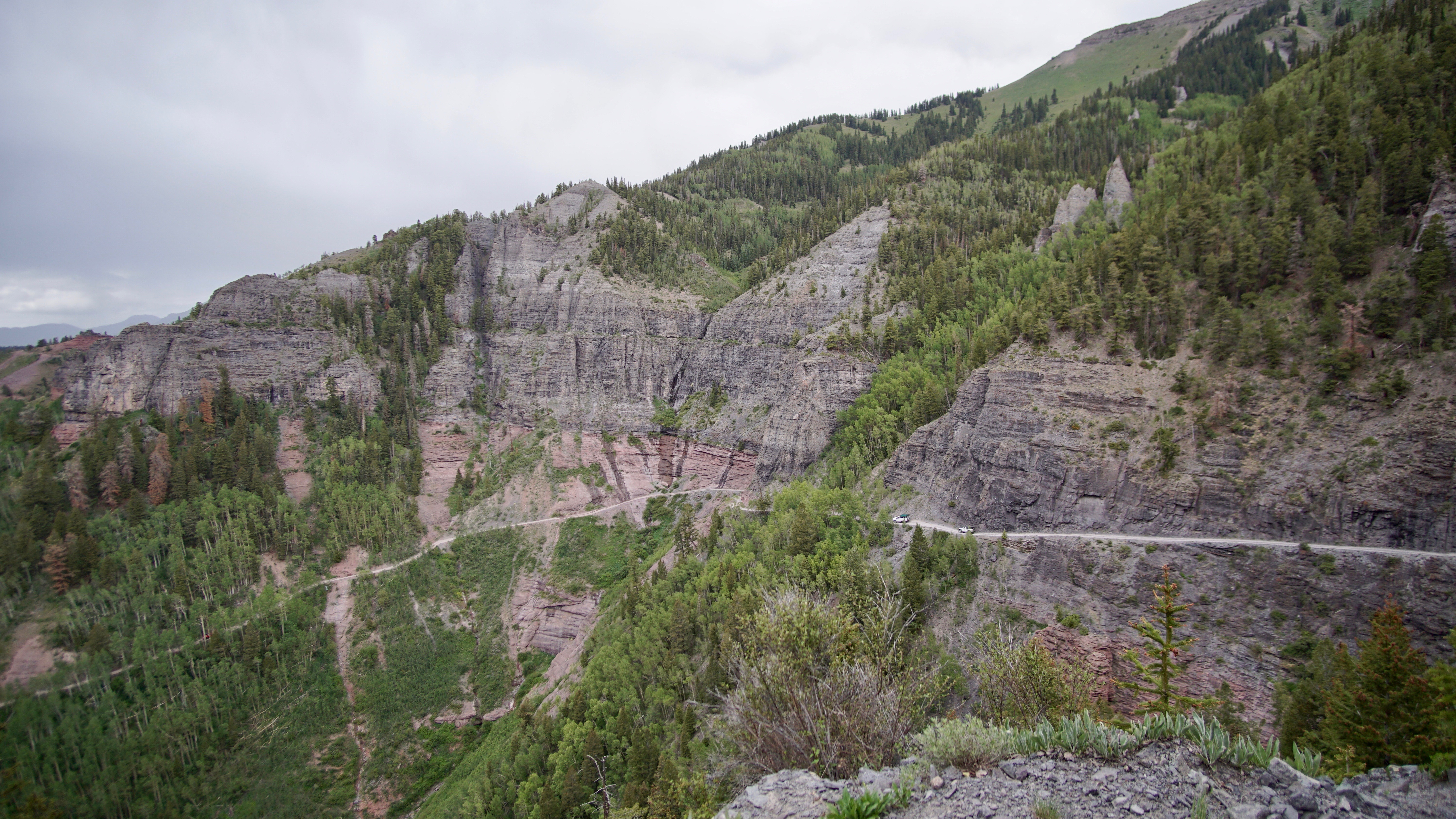
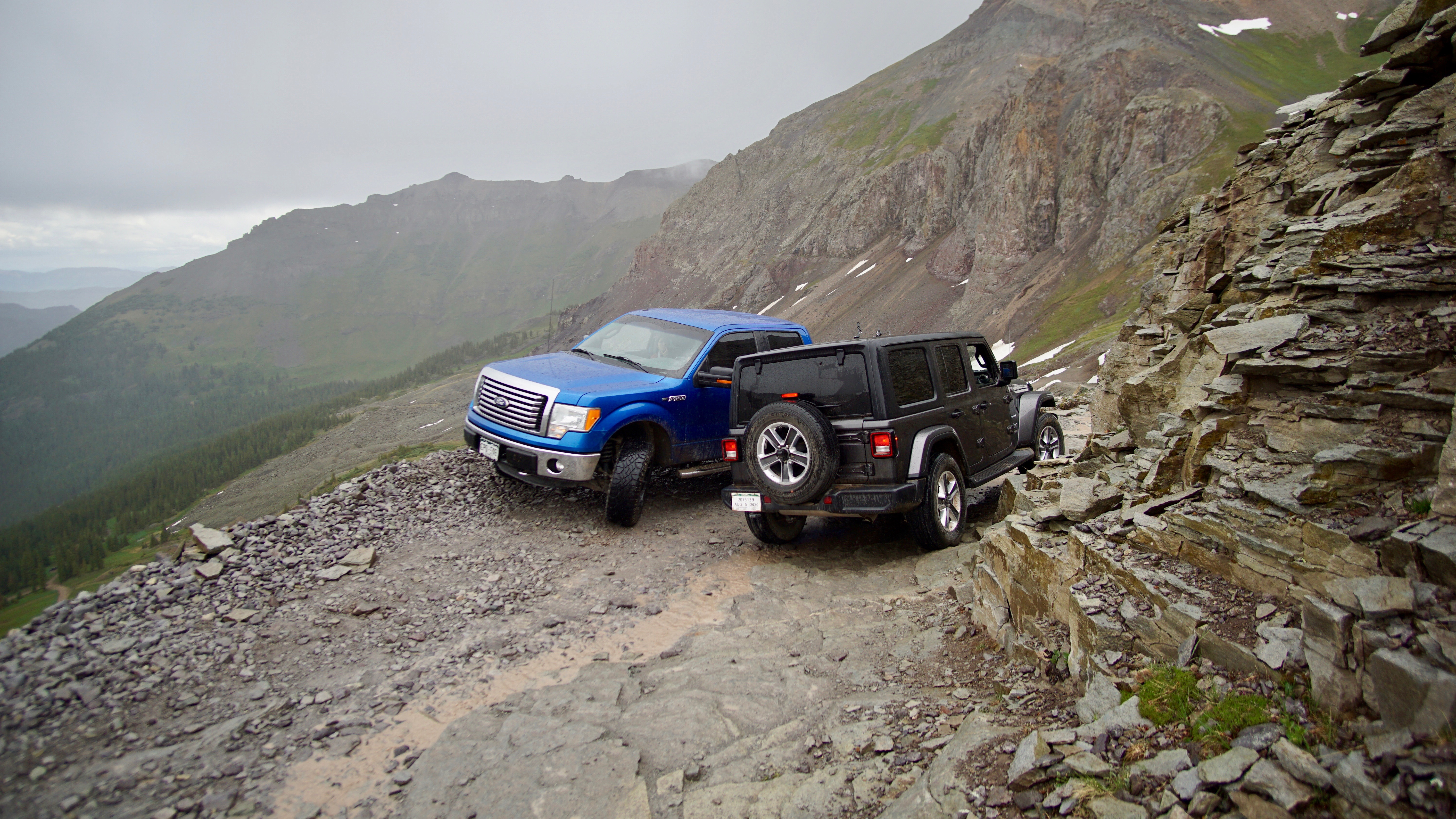
Unfortunately, if I thought Ophir Pass was scary, I was in for quite a ride on Imogene Pass! Imogene Pass, while less bumpy than Ophir Pass, had more technical spots and winded in and out of canyons on a mostly-one-lane road where we couldn’t see if another vehicle was coming around the canyon corner. Oh, and of course, like many of the 4WD mountains roads in Colorado, by default it also had a scary shelf road for a majority of the way from the Telluride side up to the top of the pass.


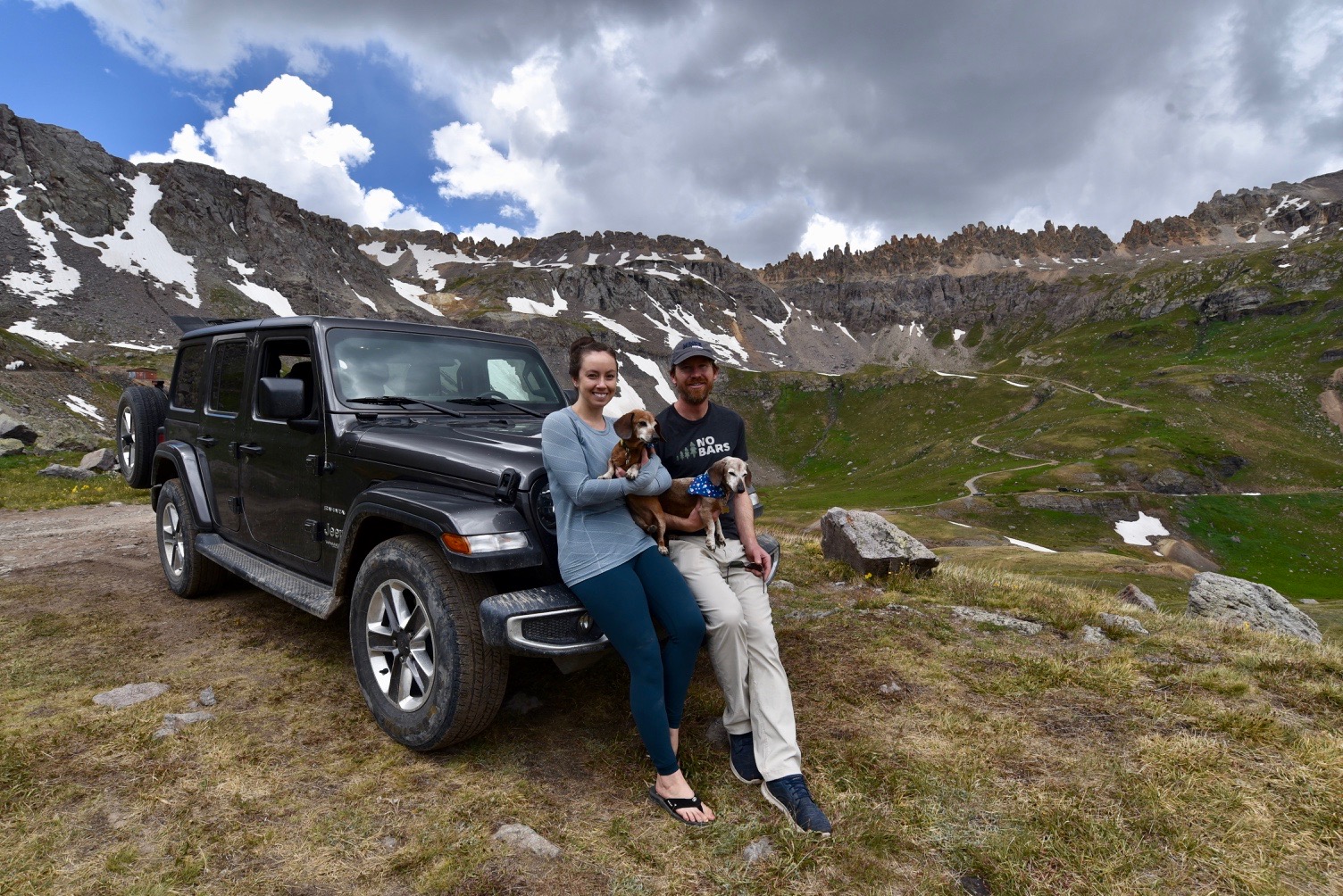
Obviously, we survived and what awaited us on the other side of the pass was the most perfect campsite we had EVER had! It certainly made up for the intolerable campsite we had the night before. As I have mentioned before, our requirements for a campsite are for it to either have a view or running water (and to not have other campers ten feet away). With this campsite, we had it all! We enjoyed the rest of our day at this campsite in absolute peace and even had a few visits from deer wandering through a field nearby.


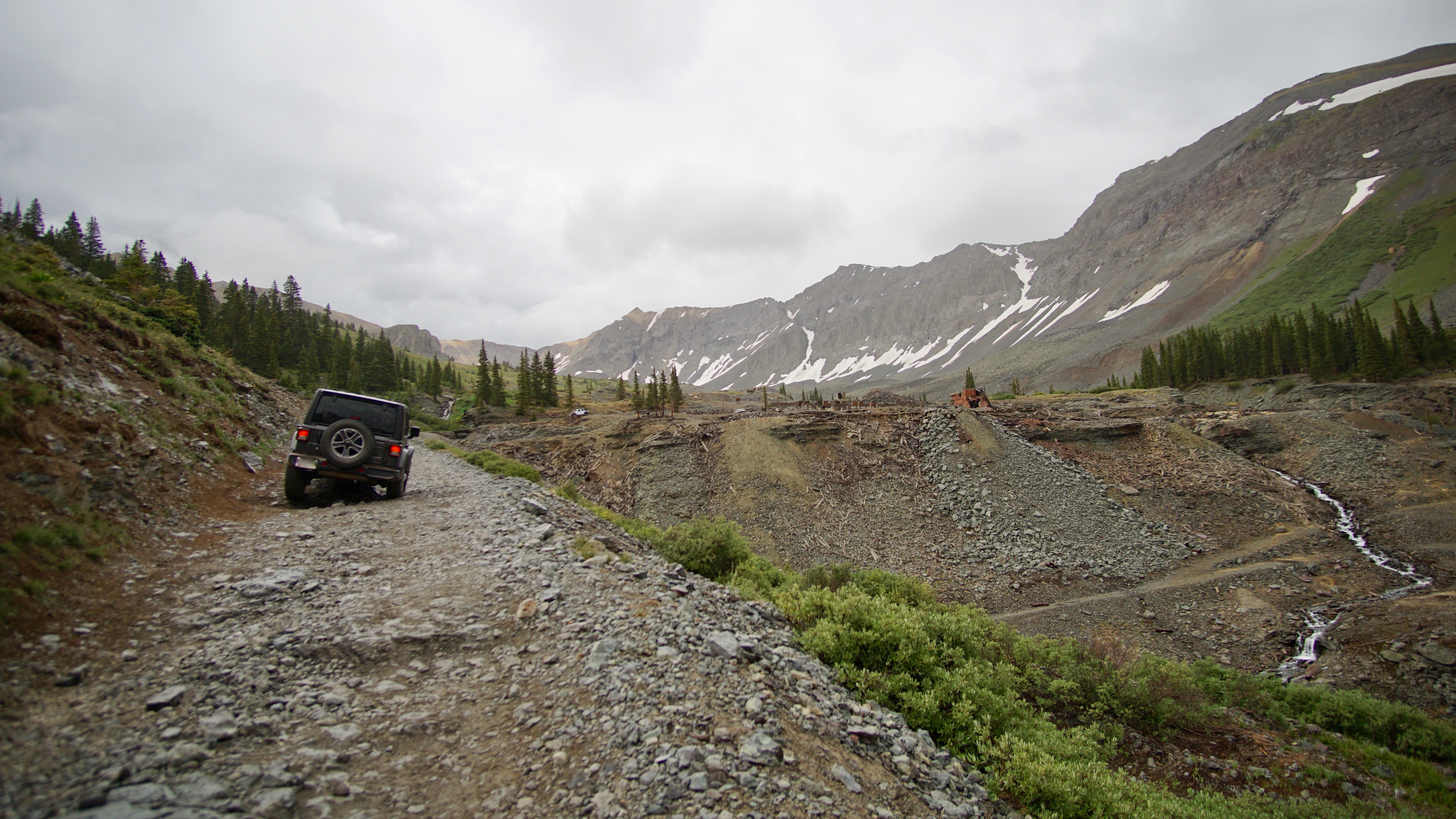
The next day, we completed the rest of Imogene Pass, with a side trip to Governor’s Basin, and called it a wrap on another eventful weekend camping and Jeeping.


Too bad about the annoying first night but glad you finally found a peaceful place to sleep. Congrats to Em for doin’ the driving, even if only briefly.