After booking our August trip to Iceland, we spent several months not knowing whether we would get to see a once-in-a-lifetime bucket list item, an active volcano with lava! We had visited Iceland in 2018, and although the country is known as the Land of Fire and Ice, the latest volcano eruption, Holuhraun, had occurred in 2014 and was not easily accessible.
Fagradalsfjall volcano woke up in Iceland on March 19, 2021, and it was unique and rare in that, not only was it accessible, but it was gently spewing lava into a relatively peaceful, bright orange river that spectators could watch from really close up. We had no idea if it would still be active by the time our trip arrived in August. In fact, because we didn’t want to get our hopes up about seeing it, we intentionally hadn’t kept track of the volcano status all summer long after we booked our trip.
A week before our trip, we were so thrilled to find out that the volcano was indeed still erupting periodically. However, with volcanoes being such fickle, unpredictable things, we still did not get our hopes up of being able to actually see lava because we realized that we would have several other factors to contend with, including weather and timing a visit with an eruption.

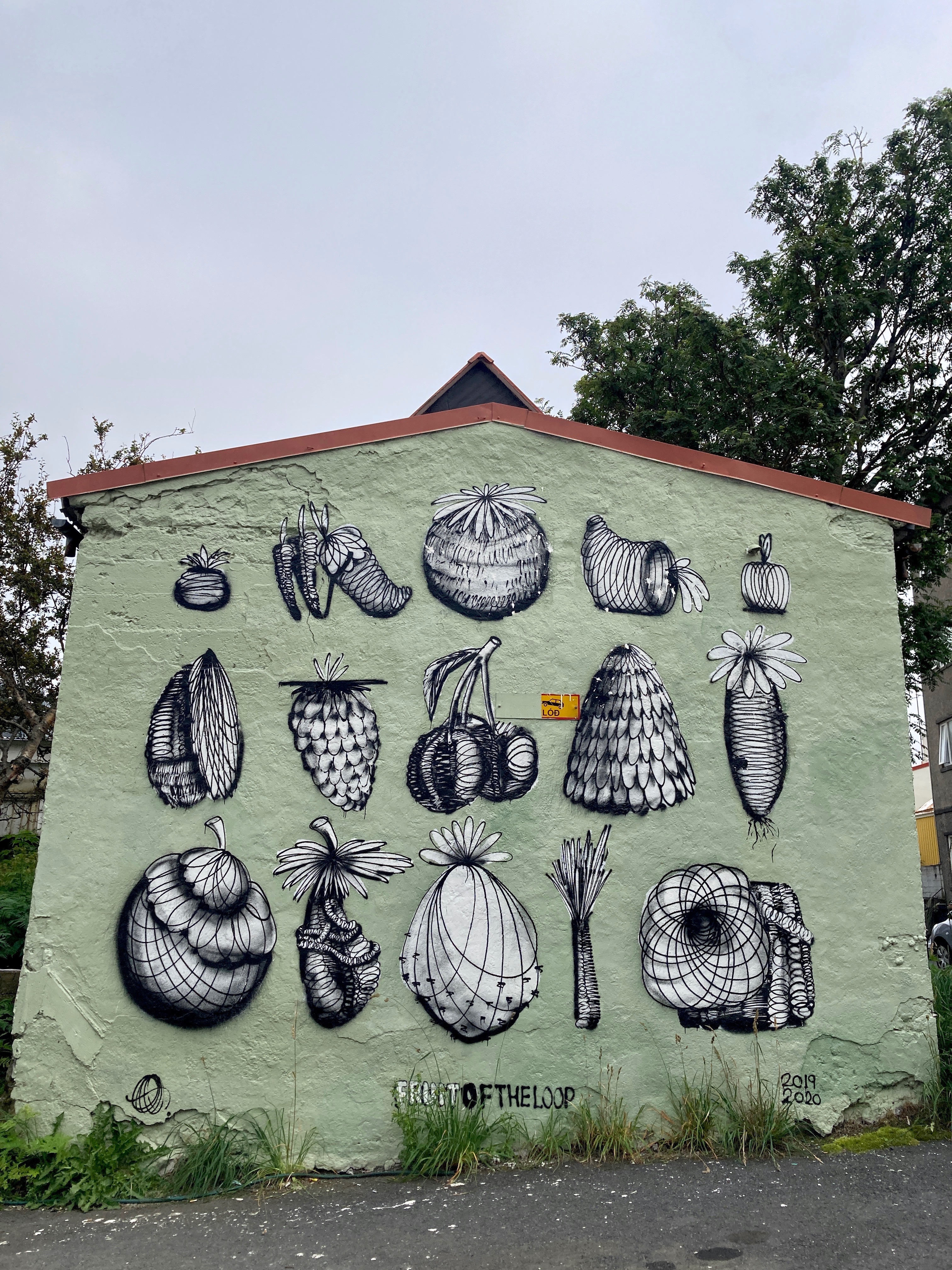
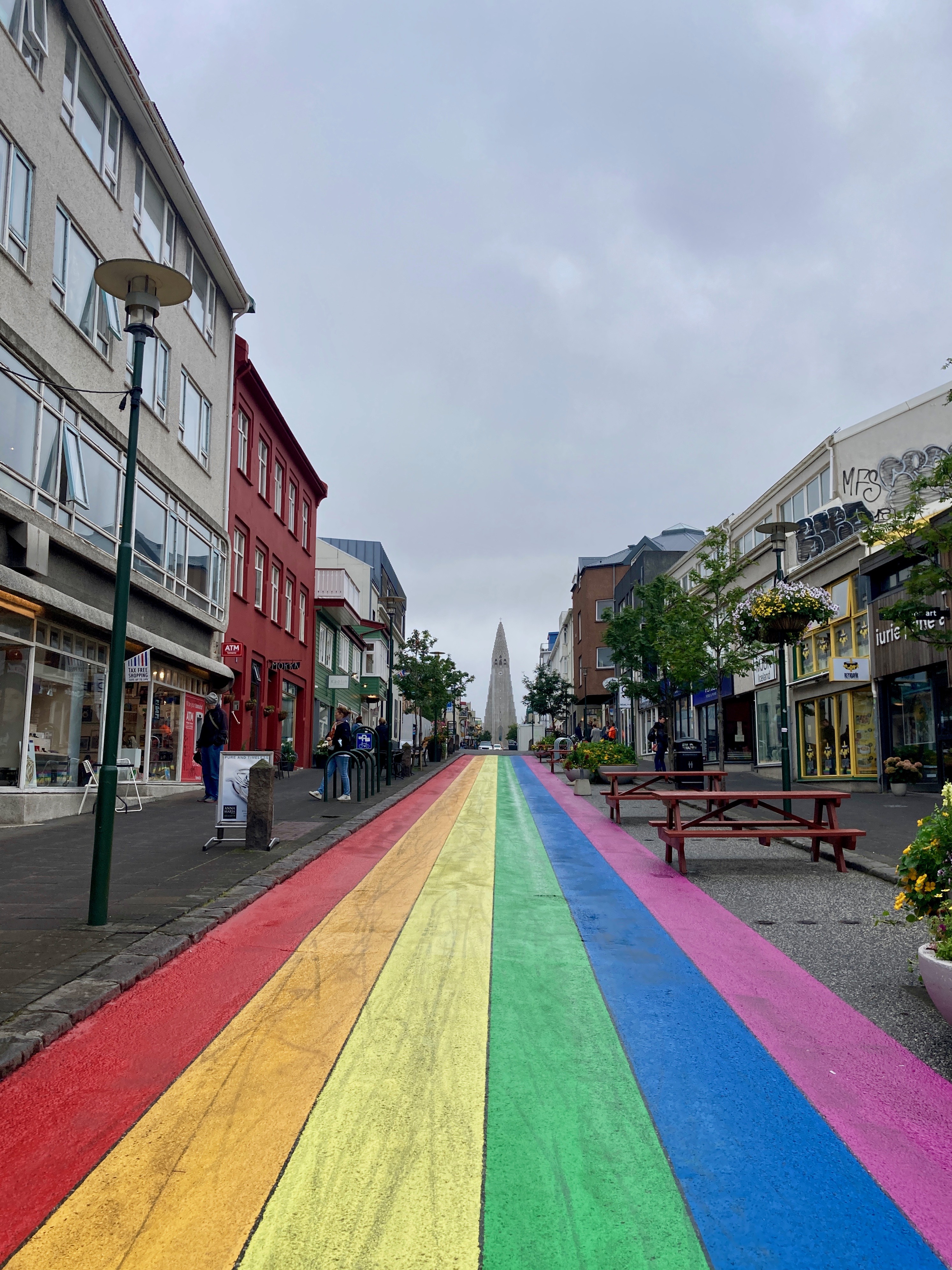
After 16.5 hours spent traveling from Denver to Iceland via trains, plane, and buses, and 24 hours spent exploring the capital and largest city, Reykjavik, we wanted to just skip ahead to see the one big thing we came to Iceland for!
We had been obsessively watching the live camera views of the volcano and the morning of our first full day, we awoke to see that the volcano was buried in thick fog. In the time it took us to pack and check out of our Reykjavik condo, the fog had cleared and the volcano was actively erupting! This was unbelievable luck and perfect timing because the volcano was located fairly close to the main city of Reykjavik and we were hoping to visit the volcano first before starting our 12-day Ring Road trip around the island.
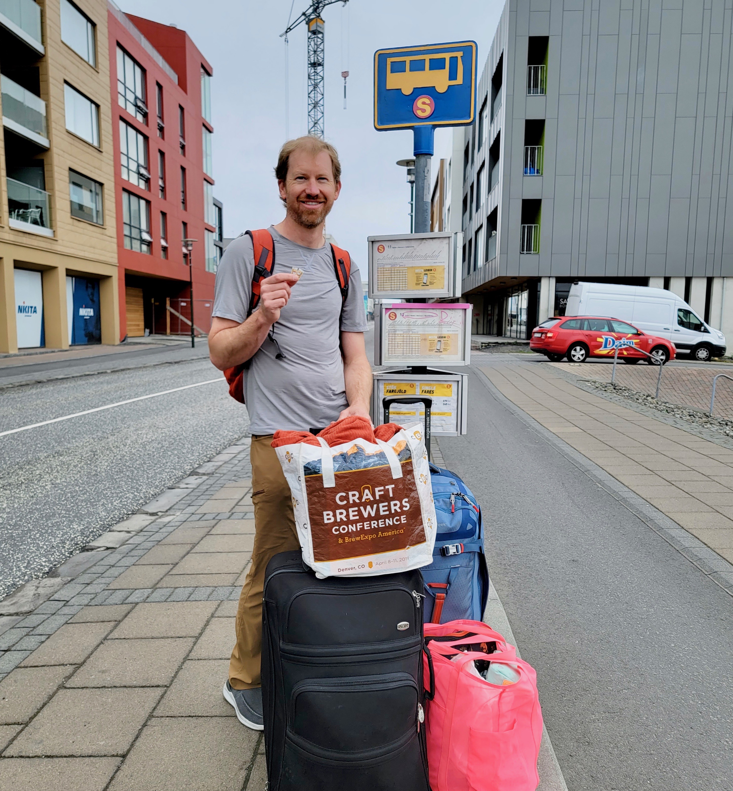
One big thing still stood in the way of us getting to the volcano and that was transportation! We had stayed the night in Reykjavik without transportation and had an hour-long bus ride and a 20-minute walk to get from Reykjavik to the vehicle rental place, as well as a 40-minute drive from the vehicle rental place to the volcano trail parking lot.


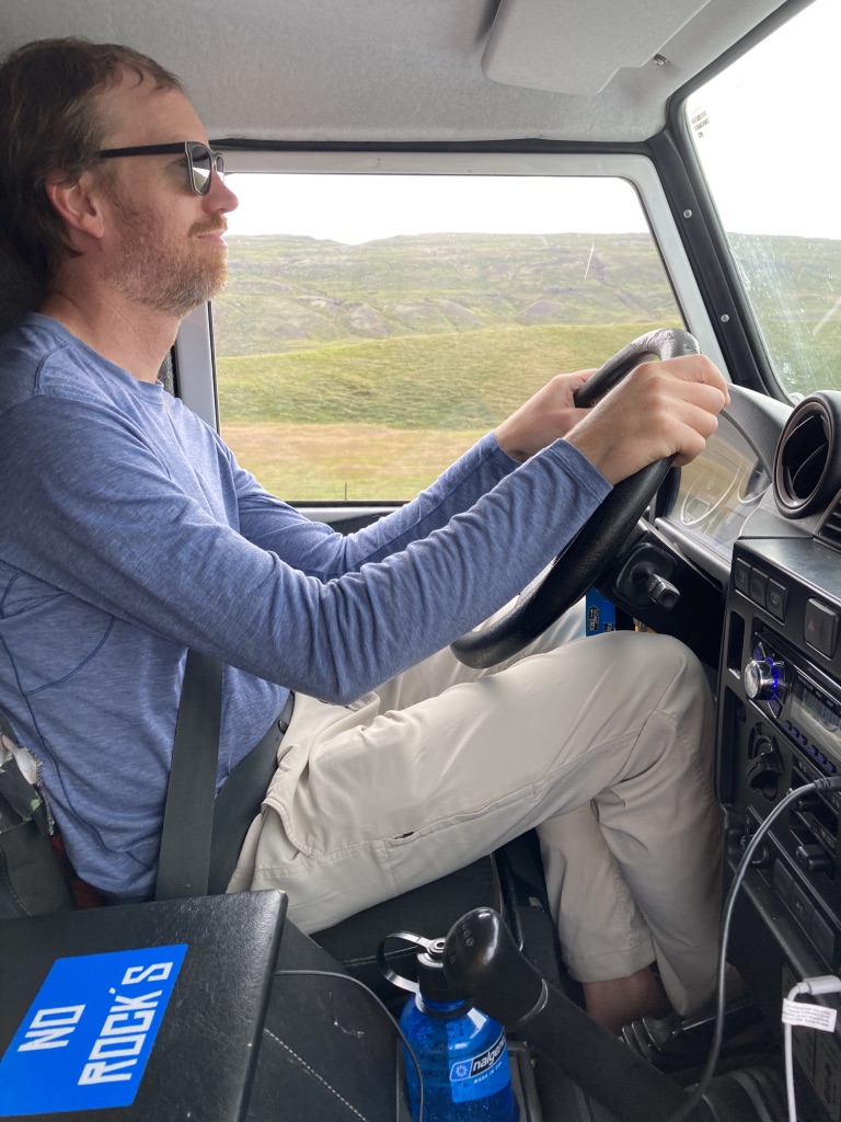
Hubby had been put in charge of finding a camper vehicle for our trip and he had chosen to rent a manual transmission 4WD Land Rover Defender from Kuku Campers. When I found out the particular vehicle he had chosen (and conveniently already booked), I begged and pleaded with him to call the company back up and get something more roomy and sensible, like an actual camper van. He was so excited about his choice though and was looking forward to having the capability to do river crossings in the rough, but scenic highland roads.
When we arrived to pick up our vehicle, I had hoped the vehicle would be more roomy in person than it appeared in the few photos of it I could find online, but it was exactly as cramped as I had expected! We debated again whether to switch to a more sensible vehicle and one with an automatic transmission so I could help drive, but with the volcano awaiting and the fact that we didn’t have time to bug the company about checking for other available vehicles, we decided to just go with it. It was going to be a cozy 12 days traveling around the island in our “Land Over”… but no matter, we were volcano-bound!


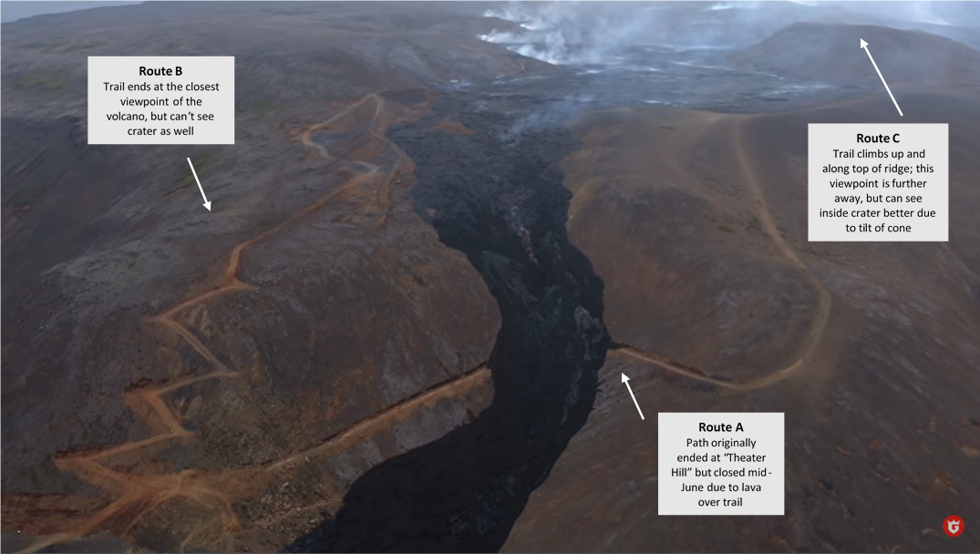
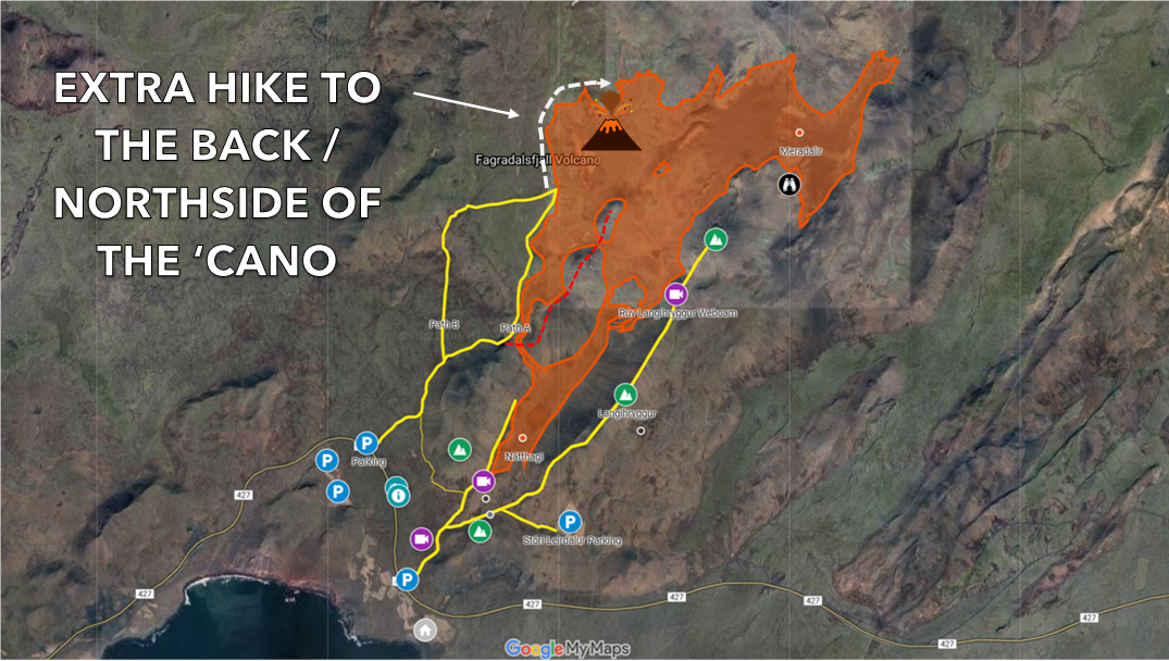
There were three trails to Fagradalsfjall volcano – Routes A, B, and C. There wasn’t much information about the routes and what little information there was, was somewhat confusing and seemed to incorrectly mix up the routes.
Routes A and B shared the same initial portion of a trail that started off in a parking lot on the southwest side of the volcano. Route C started off from a parking lot on the southeast side.
The most popular trail, Route A, lead to the closest viewpoint of the volcano… until lava covered a huge portion of the trail in mid-June, thus causing the closure of the last portion of the trail. Most of the early photos of the volcano were from an amazing viewpoint right in front of the volcano on Route A called Theater Hill.
With Route A no longer an option, we had to decide whether we would do Route B or C. Both were about the same length (~4 miles roundtrip for Route B; ~5 miles roundtrip for Route C) and about the same difficulty. The main difference seemed to be that Route B led to a closer viewpoint of the volcano, whereas Route C was a further viewpoint on a ridge, but a more interesting view of inside the cone. What we didn’t know was whether both would have views of the lava flows. Some of the most recent videos showed that there were incredible lava flows visible from Route B, but that could easily change from day to day.
We had a tough time deciding on what would be the “best” route to do, but ultimately decided to Route B because of the closer view of the cone and the recent views of the lava flow.

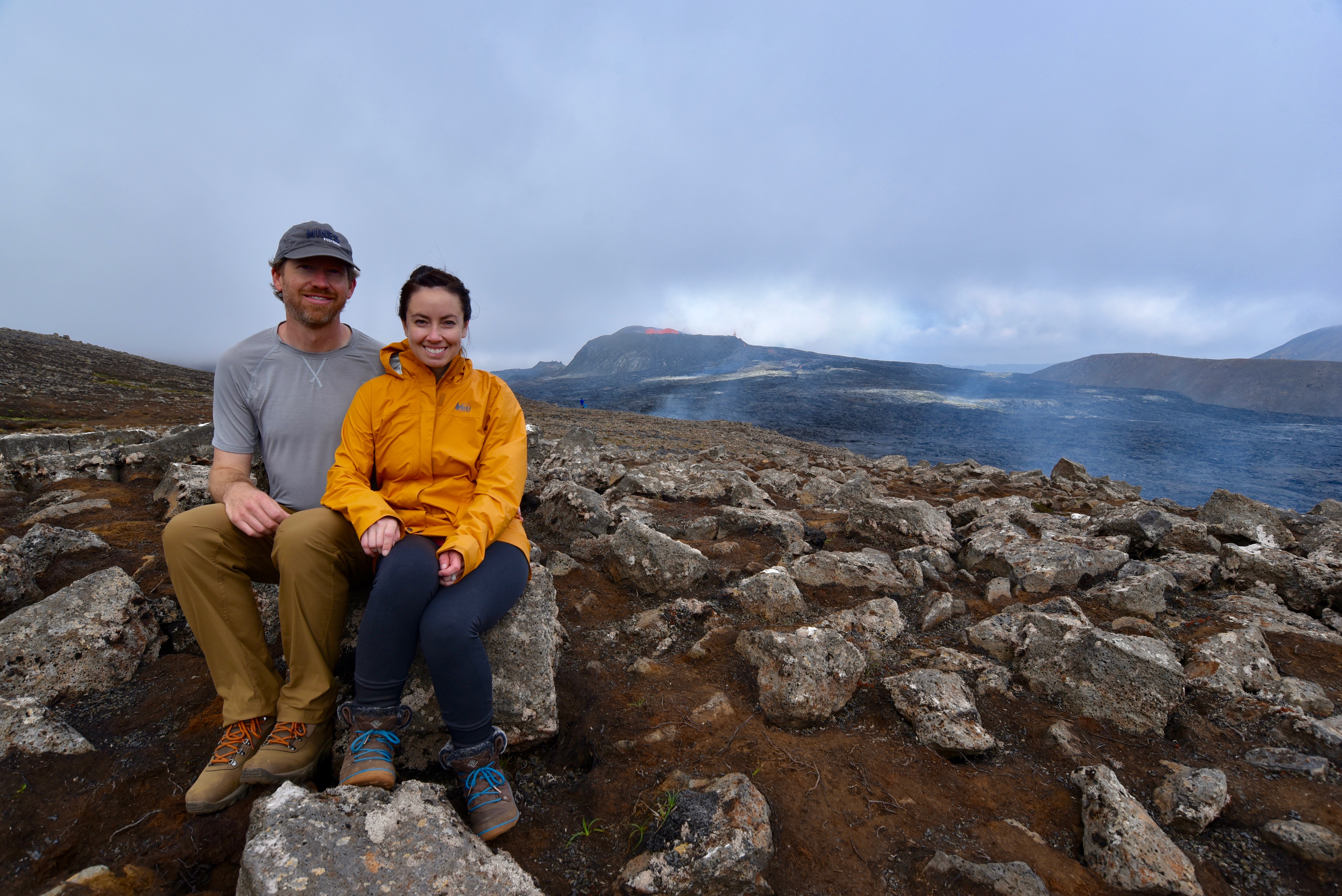
We started the hike at 3 p.m. and within 35 short minutes of hiking, the mystery of whether we would see lava or not was solved. From a far distance and through the thin fog, we could see bright orange lava exploding up into the air from a glowing lake at the center of the cone. What a sight!!!
The volcano had drastically increased in width and height from the early photos we had seen online and because of its immense size, lava wasn’t able to easily overcome the tall walls and provide the explosive sight that occurred during the Spring and early summer months. Nonetheless, we were beyond mesmerized and impressed by the sight… and we still weren’t as close as we could get to the volcano!
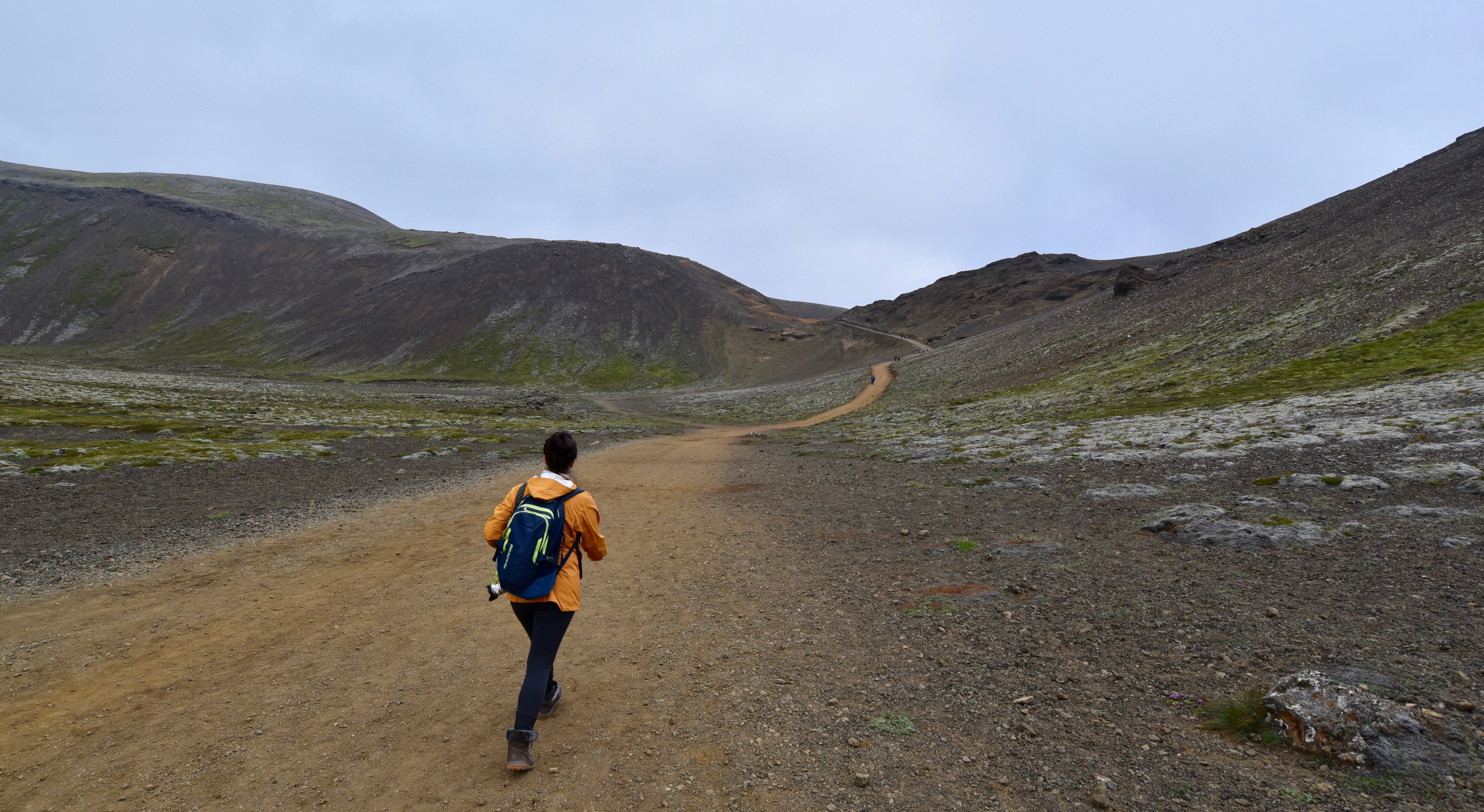


We took a few photos but were eager to get as close as possible to the volcano and as soon as possible, not knowing whether it would shut off like a faucet at any moment! As much as we wanted to run to the closest viewpoint of the volcano, the closer we got, the worse the trail got, and soon, no trail existed at all! The ground was covered in sharp lava rocks and paired conveniently with dangerously soft, mossy landscape, ready to twist your ankle if you dared take your gaze off the ground and onto the beautiful, tempting volcano.


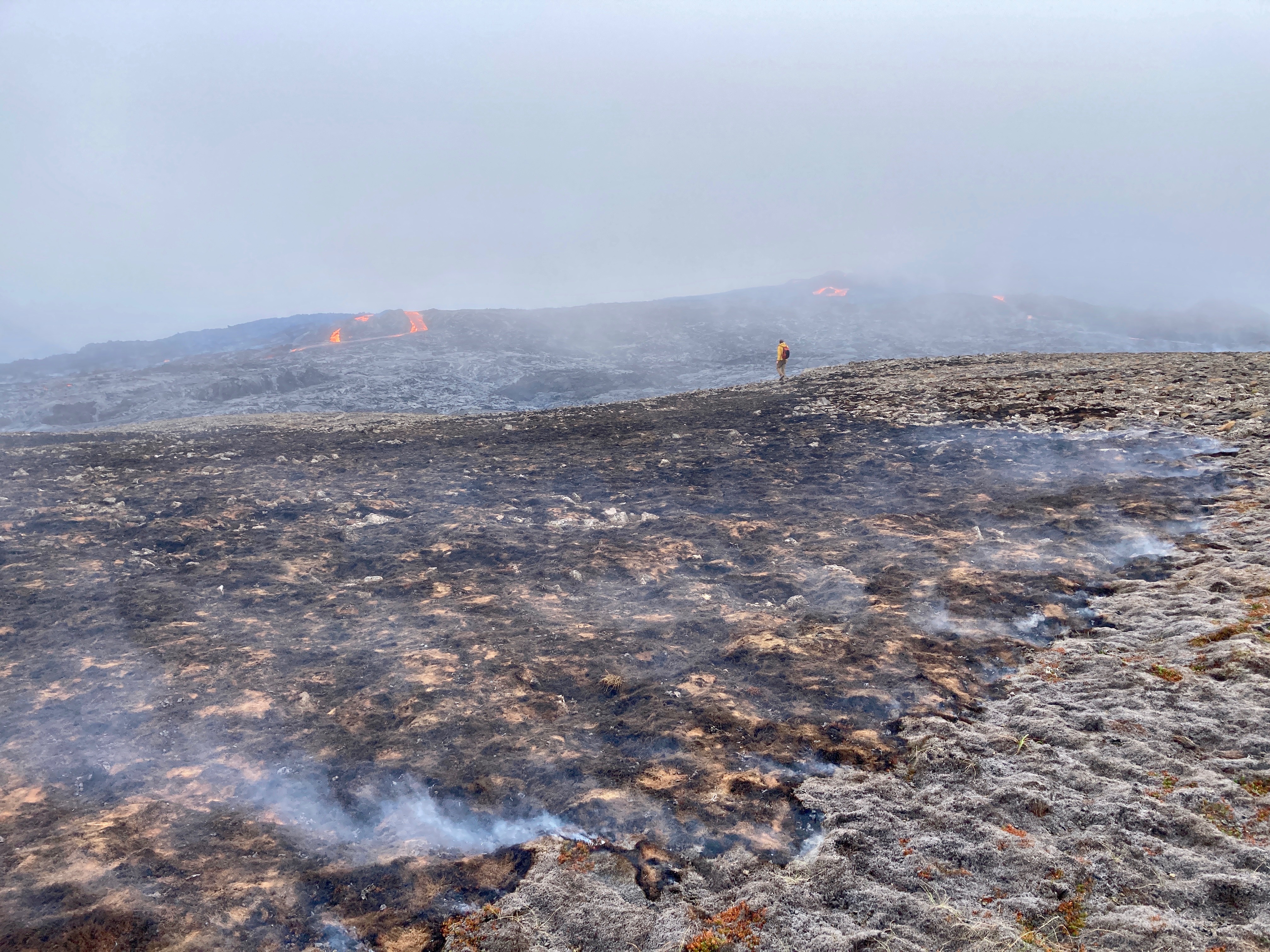
After spending almost two hours taking a literal gazillion million photos and videos of the volcano, we decided to walk around to the back (north side) of the volcano. Few people seemed to travel beyond the west viewpoints on Route B because the tall wall on the backside of the cone made the lava-less views less spectacular; however, we had seen recent videos of the backside of the volcano with lava flows coming down it. Since we had not seen much lava flow from the west viewpoint of the volcano, we had hoped to see more action on the north!
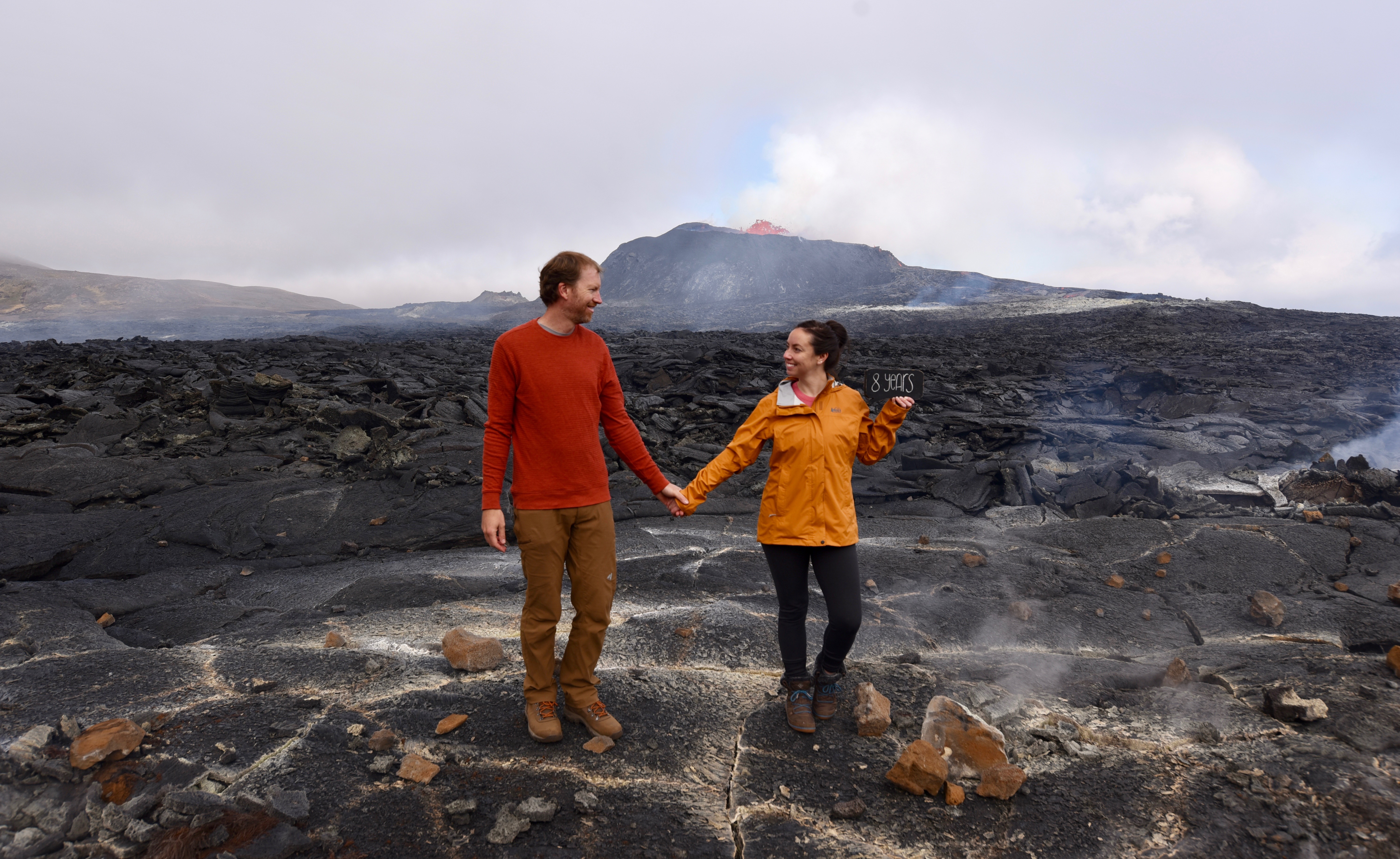
We spent an additional hour slowly hiking to the back of the volcano (with several stops for photos along the way) and we eventually did reach some lava flows that could be seen in the distance spilling into a valley below. We found out later that the lava flows coming down the backside were likely from a different cone/fissure adjacent to the main one, but because we were mostly at ground level with the tall, petrified lava field, it was impossible to see the source of the lava flow.


While walking around to the backside of the volcano, we had wondered if we would be able to make a large loop around to the east side of the volcano and eventually connect back up to Route C, but once we reached the north side, we could see that that endeavor would be nearly impossible with the large lava field covering the north side.
We spent a long time admiring the different views from the backside of the volcano, including witnessing a field of grass and moss burning, with seemingly nothing close by to necessarily start the burning (yes, I understand there was a volcano nearby, but it was still mystifying!). It seemed like wherever we looked, either up or down or in the far distance, we were experiencing something new for our senses. We didn’t want to leave!


It was actually a good thing that thick fog eventually rolled in and the direction of the winds caused suffocating sulphur gases to blow right at us, so that was our cue to start heading back!
We hiked a total of five miles and spent 6.5 hours visiting the volcano that day. We had consciously tried to soak in every single moment as much as possible that day, knowing that the experience would only live in our minds (and a few gazillion photos) after this incredible day, but it didn’t seem to matter how much we tried to slow down and enjoy each moment because even now as I put this story down in words, it feels like a distant memory that’s not nearly the same in photos or videos.
We were so distracted by our volcano visit that day that by the time we finished our hike at 8:30 p.m., we realized we hadn’t even considered where we would sleep that night and how far we would have to drive to get there. Oops!
We ended up finding a campground two hours away and arrived in the dark having no idea what our inaugural Ring Road campsite looked like. We were also so exhausted that we didn’t even care how small the sleeping quarters were in our Land Over.
The next day would be the official start to our Ring Road journey and it was impossible to imagine what could top our amazing volcano visit. Little did we know that nothing would, except a repeat visit to the volcano at the end of our trip. But more on that later!
