On the fifth day of our Big Island trip, we could finally do our much-anticipated backpacking trip from Waipi’o Valley to Waimanu Valley on the Muliwai Trail!
I feel guilty admitting that after we booked our Hawaii trip in April, I actually wasn’t as excited to visit the Big Island as I should have been. I had read many travel forums that sung high praises of the Big Island, which is why we chose to visit a different Hawaiian island from the two we had already visited, but once I started looking for adventures to do and sights to see, the island seemed to fall flat with just overcrowded touristy sights.
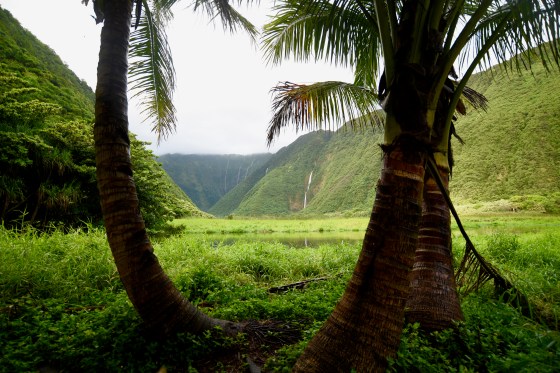
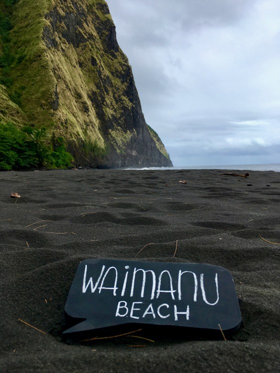
Eventually though, in my never-ending quest for a memorable adventure on the Big Island, I found an incredible beach, accompanied by an incredible waterfall we could visit. This beach and waterfall required a long and arduous trek — specifically a 15-mile roundtrip trek with two big river crossings and over 5,000-feet elevation gain that was best done in a two-night backpacking trip — but it was love at first sight with the gorgeous three-tiered waterfall and surrounding green valley that defined the backdrop of the beach at the end of the long hike.
Backpacking is not necessarily my forte, since I don’t know the meaning of packing light when it comes to food or clothing! Adding a backpacking trip in the middle of our vacation would certainly complicate our luggage situation, along with other trip logistics, but this adventure had our names on it and I… could… not… wait!

Map of the Muliwai Trail on the north side of the Big Island. The hike starts at the Waipi’o Valley Lookout on the right side of the map and ends at the Waimanu Camp Grounds on the left side of the map (with the official trail section noted by the red line).
In the months leading up to our trip, I tried to do just enough research to know what to expect, but not too much that I would spoil the surprise and beauty of what our three-day backpacking trip would reveal.
That said, I wish I had done just a tiny bit more research, as I arrogantly assumed, coming from Colorado and being in relatively decent shape, that this hike wouldn’t be as difficult as other bloggers had recounted and I wouldn’t need to know every detail of what to be prepared for… but I ended up having my butt kicked and handed to me on this hike!
The biggest unknown factor we faced going into the hike (and the one I underestimated) was the total trip mileage. The trail mileage online stated the hike would be 15 miles roundtrip, but that was starting from the official trailhead in Waipi’o Valley (which was quite a distance away from where backpackers were expected to park) and ended at the start of the campsites in Waimanu Valley (which stretched almost as far as a mile down the beach from the start of the first campsite). It was common for backpackers to hitch a ride for much of the arduous beginning portion of the hike from the parking area and down a steep road to the beach in Waipi’o Valley. As a result, there didn’t seem to be a consensus on what the actual total mileage was without hitch hiking. While we weren’t opposed to hitching a ride, we also knew not to count on getting a ride. Moreover, we kind of looked forward to hoofing it to get the “full experience” of the hike!
Well, we ended getting the “full experience” alright…
Day 1 >> August 19
On the morning of our backpacking adventure, we separated our backpacking items from our cute beachwear and pool floats. We ended up with some pretty heavy packs, which included some of the following essential items we needed in order to survive our three-day, two-night backpacking adventure on the Muliwai Trail:
- Lightweight two-person backpacking tent (we use the REI Quarter Dome SL 2 for our tougher hikes because the tent weighs a mere 2 lbs, 8 oz)
- Lightweight camping blankets (specifically, the Kelty Bestie Blanket that measures 75.5″ x 42.5″, which is a cheap knock-off to the more popular Rumpl blanket)
- Thin, two-person sleeping bag liner
- Inflatable sleeping pads (hubby has an older sleeping pad, but we purchased a new one for me a couple of years ago — the REI Flash All Season Insulated Air Pad)
- Inflatable pillows (we use the Marchway Ultralight Compact Inflatable Camping Pillow, but there are a ton of cheap, comparable options on Amazon)
- Head lamps
- Water filter
- Cooking essentials such as stove, butane, cooking pot, sporks, cups, bowls
- Environmentally-friendly dish soap
- Food/snacks (in plastic containers to keep out bugs)
- Bug repellent
- Sunscreen
- Backpack cover (for rain)
- Dry bag (for rain and river crossings)
- Toiletries such as toothbrush, toothpaste, face wash, blister bandaids, anti-itch cream, toilet paper (and ziplock to put used TP in), etc.
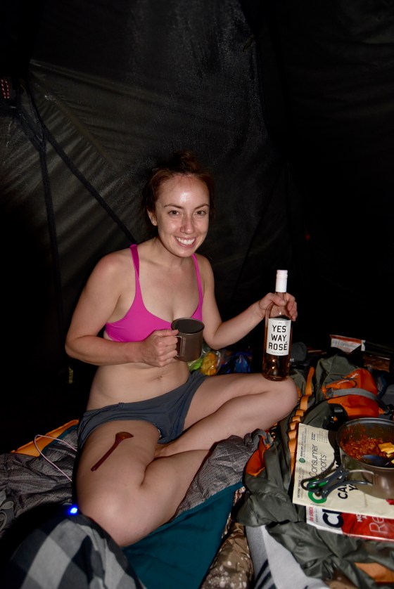
We also brought a few heavy, non-essential items including wine/alcohol, both our cameras (because we didn’t want to leave them in the car), a camera tripod, and a lightweight backpacking chair.
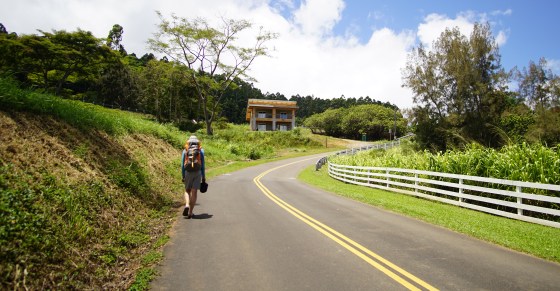
We hit the road around 10 a.m., which was much later than we would have desired. To make matters worse, the drive to get from Kona to the north side of the island was a little over 1.5 hours.
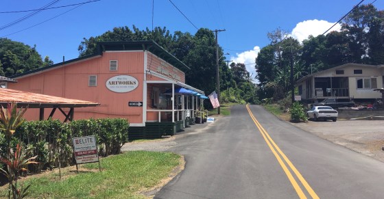
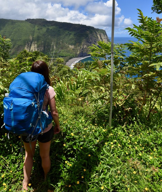
Our hike officially started at 11:50 a.m. at the Waipi’o Valley Artworks Gallery parking lot after we forked over a whopping $60 ($20 per day… not per night… go figure!) to park overnight for our hike. The hike wasted no time kicking our butts, as even the .5-mile/15-min walk from the art gallery parking lot to our first “stop”, the Waipi’o Valley Lookout, was much more hilly than we expected. It was also a bit awkward walking along the sidewalk-less street with large, heavy packs on, considering that many visitors were probably unaware that there was even an intense backpacking trail down from the touristy lookout.

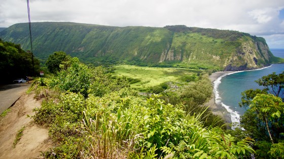
Once we reached the Waipi’o Lookout, we marveled at the hike that was waiting for us on the other side of the valley, and more importantly, the steep road right in front us that we still had to get down in order to even start the official trail!
The Waipi’o Lookout is the end of the road for many vehicles, as the road down to the beach below turns into one of the steepest roads in the United States. Only four-wheel drive vehicles can continue past this point and even walking on it is no joke. The moment our feet stepped onto the pavement of this descent, they were literally trembling! It was impossible to walk any faster than our wobbly legs would allow.
Before we continued on our hike, a park ranger at the Waipi’o Lookout stopped us, clearly noting from our large packs that we were headed out to do the Muliwai Trail. The ranger verified that we had obtained a mandatory campsite permit (indeed we had) and then questioned our footwear choice.
I do almost all my outdoor activities in flip flops or sandals when I can, from biking to hiking, so it was a given that I would do our backpacking adventure in sandals. Hubby, on the other hand, was very reluctant to wear sandals for this particular hike, but I somehow convinced him sandals were the way to go! However, having the park ranger question our footwear choice probably did nothing to help hubby’s confidence in his footwear decision as we were about to embark on a grueling, three-day hike… but there was no turning back now!
As we started our descent down the steep Waipi’o Valley road, we quickly realized that without pre-arranging a ride, it was unlikely we would get lucky enough to hitch a ride in the middle of the day. Of the few vehicles headed down to the beach, most were just small jeeps, not roomy enough for two extra people with two large packs and other vehicles were already at full capacity with the driver’s own friends and/or belongings. We ended up hiking down the entire one-mile road to the Waipi’o Beach without any vehicles passing by that could give us a ride, but it was still a fun experience we could say we did!


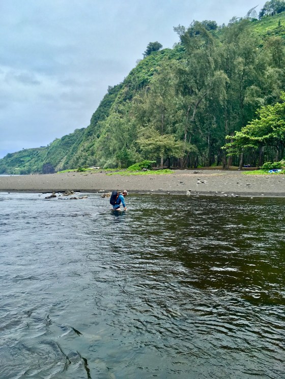
At 12:50 p.m., an entire hour later, we were finally on the beach! At the beach, we quickly came to our first big water crossing at the Wailoa Stream and hubby confidently, and without hesitation, began to wade the waters. The stream looked deceptively calm further upstream where hubby began to cross, but it wasn’t long before he began having difficulty crossing. Not only was the stream filled with slippery rocks, but in certain parts, it would get suddenly deeper and swifter. Not willing to give up, hubby forged on and eventually crossed successfully.
Meanwhile, I stood at the other side panicked and wondering how on earth I was going to cross, especially now that I had been abandoned. Some locals nearby, clearly sensing my apprehension and confusion of how to cross the stream, kindly offered me advice to cross further into the ocean, stating that it was less rocky there.
Without much choice, I began to cross the stream where they suggested, but quickly retreated when I realized that the incoming ocean waves would momentarily make me feel dizzy and off-balance.
We had brought a dry bag for our trip, specifically for this scenario of keeping any necessary items dry while crossing the two larger streams if they were bad. However, while packing for the trip, we had wrongly and confidently assumed the stream crossings were going to be easy-peasy-lemon-squeezy and therefore, used the dry bag to store our food in and stashed it at the very bottom of my pack. *cue face palm* Not wanting to waste any more precious time, I was stubbornly unwilling to dig the dry bag out from the bottom of my bag to protect my camera, which was the one major thing that kept me from more confidently plowing across the stream and not caring if I fell into the water.
Luckily, after I retreated back to the banks of the stream, the locals began to cross and I could see that they were crossing even further into the ocean than I was attempting to and I felt more confident seeing the exact path they used and that it was indeed possible to get across safely.
I attempted to cross again and the locals ended up being exactly right; the river was much “easier” to cross in the ocean where there were no rocks hidden beneath the water, but it was still quite a challenge to walk in the water, as each wave threatened to knock me off-balance with my heavy pack and valuable camera strapped to my side. Fortunately, hubby met me halfway and grabbed my camera, and after this unexpectedly long, 30-minute obstacle, we were finally on our way again!
Hiking across the rest of the beach was yet another obstacle that we had not expected. Soon after the stream crossing, the beach turned from sand to obnoxious big rocks that were exhausting to walk on. Little did we know (until we hiked out on the third day), that there was actually a sandy and shaded trail further in the trees that stretched from the river to the trailhead.


At 1:35 p.m., we had finally reached the official trailhead and starting point for the Muliwai Trail. By this point, we were three miles and one hour, 45 minutes into our hike and it was no surprise, my mental and physical energy were both already feeling very depleted, which should have been a foretelling sign that this hike was not going to go well.
At the trailhead, I was able to choose a hiking stick from a few left behind by previous hikers. This was a blessing for me because we had actually forgotten our hiking poles back home in Colorado, which we had specifically purchased for this backpacking trip. Du-oh.
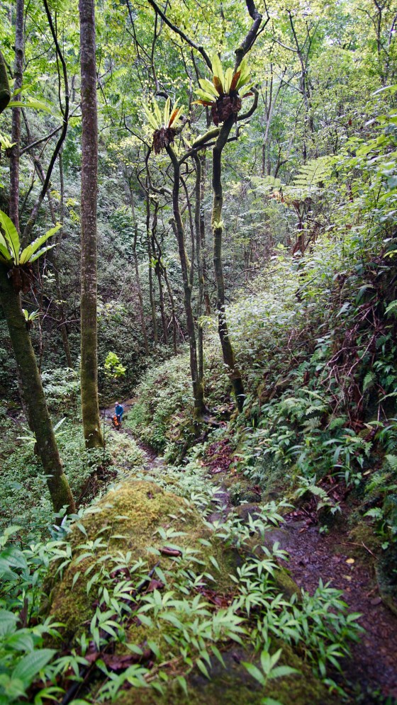
The next portion of our hike was a steep, one-mile section of switchbacks called the “z trail”. I thought that once we got past this section, we would surely just coast from there on the relatively flat ridge at the top of the valley. There was light at the end of the tunnel!
We plowed through the switchbacks, taking short breaks at the overlooks along the narrow trail to admire the portions of the hike that we had already accomplished, including the astonishingly steep 4WD road across the valley.
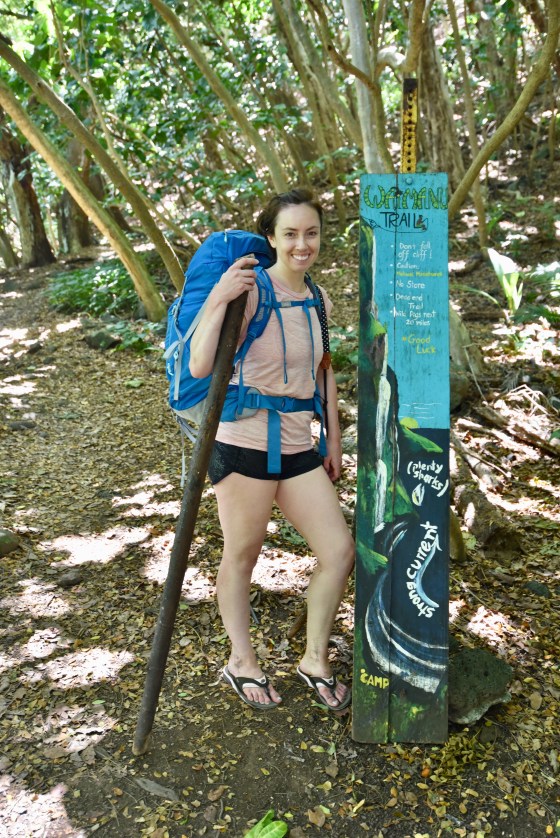
I’m not sure why this sign was labeled the Waimanu Trail when the official trail brochure calls it the Muliwai Trail, but the sign was pretty darn cute, nonetheless. We were quite amused by the artistic rendering of the Waimanu Valley that pointed out “plenty sharks” near the beach.


After finishing the switchbacks, we entered into a forest that made us feel like we had been transported to a forest in Oregon. As it turns out, back in the 1930s, a non-native tree species was introduced to the top of the ridge and this odd forest was likely the non-native forest the trail brochure was referring to.
A short while later, after the non-native forest turned back into a tropical forest, we reached the top of the ridge and the first helipad landing. The helipads were used for emergencies, but from the looks of them with the overgrown grasses and overstretched trees, it didn’t seem possible for even a tiny drone to land on them! There were a total of four helipads that we could use to “count off” during our hike on the ridge to gauge how far along we were on the trail. Hubby, being the “numbers” guy that he is, nonchalantly commented at the first helipad that we had five miles ahead of us at the top of this ridge, and that is when I just about lost it!
Side note – I didn’t realize until our hike out on the third day that the reason hikers “count off” the helipads and why hubby kept annoyingly quoting mileage at each helipad was because each helipad sign literally had a notation of how much mileage was left, which I had just been too tired to read. I had just assumed hubby had memorized ahead of time all the mileages of each helipad landing because that’s exactly something he would do. Ha!!
In my mental exhaustion from the hike thus far and confusion over how much our one-way mileage would be for the day (without hitch-hiking the first section) compared to the 15-mile roundtrip trail mileage quoted online from the trailhead start, I had naively and incorrectly guessed we wouldn’t have much more than eight miles for our total one-way mileage for the day… when in fact, our one-way mileage ended up being nearly 11 miles when the day was all said and done!
The fact that we had only covered four miles in two hours and 40 minutes made it impossible for me to comprehend doing the five miles ahead of us; not to mention, that wasn’t counting the last mile and half we had to get down the valley, cross another big stream, and cross another long beach to get our campsite.
It wasn’t even that I was physically incapable of the hike, but it was other factors, such as the sharp pains I was getting in my back from my heavy pack and the fact that I hadn’t eaten breakfast or lunch, which were breaking me down mentally more than anything and making me question why I had thought this hike, which had been my brilliant idea, would be so fun and easy.
It also didn’t help that, at the first helipad, the mosquitoes suddenly came out in full force against me. I’m a mosquito magnet, so I knew to bring bug repellent, but it didn’t seem to matter how much I coated myself in Deet; the mosquitoes were relentless! I even had a “suction tool” called The Bug Thing to help with bites, but even after this one, quick rest stop, I had so many bites that I lost track of which ones I had suctioned and the tool became useless. I also ended up using so much bug spray on the hike in that I had none left on the hike out. Fortunately, the mosquitoes did not seem to be at the final beach where our campsite was. Meanwhile, hubby, who didn’t spray a drop of bug repellent on him, didn’t get a single bite the entire trip!
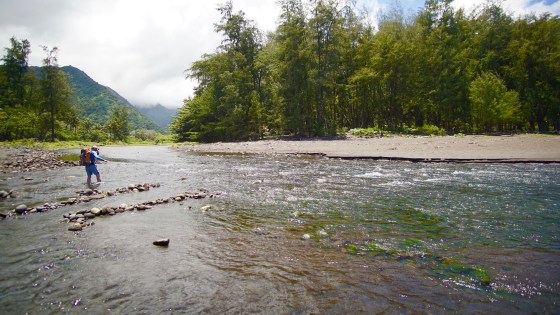
As we continued on our hike on the ridge, we had twelve small stream crossings that we could count off along with the four helipads. Some of the stream crossings were more dry than others, but none were as difficult as the two wide stream crossings at each of the beaches. However, none of these trail markers we could count helped the hike go any faster!
In fact, the distance and time between helipad #1 and helipad #2 seemed to go on endlessly to the point that I thought if the distance and time between all the helipads were this much, I didn’t think I could make it and might have to either give up and camp at a helipad or be rescued at one! Fortunately, the distance between helipad #1 and helipad #2 ended up being the longest of the four and the others went slightly quicker.
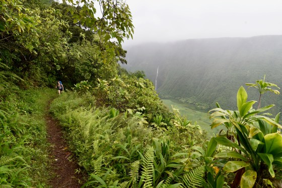
Adding to the exhaustion, bugs, and long mileage of our hike was the fact that the trail on top of the valley was not nearly as easy as some bloggers/reviewers seemed to describe. The five miles on the ridge were actually very hilly, as it zig-zagged in and out of ravines and gulches. Many times, the trail also hung precariously close to steep ledges, which forced us to stay alert when we wanted to just zone out and wake up when we had reached our final destination. One slight misstep or miscalculation of balance from a heavy pack could send us down a ravine or cliff!


At 5:50 p.m. and six hours into our long, scenic hike, we were finally on the other side of the ridge and witnessing our first view of the beach below that we would camp on. We also were catching the first glimpses of sunset, which was beautiful and unnerving all at once. We still had over a mile of steep terrain to climb down, which there was no way we could rush! Not only was the trail steep and narrow, but most of it was covered in large, slick leaves that threatened to send us off a cliff if we dared to hike any faster or less careful. Darkness was surely going to beat our race to the bottom of the valley!
To make matters worse, not only were we running out of daylight, but we were both running out of water. I had brought two big water bottles on the hike thinking it would be more than plenty, but by the middle of the hike, I was already conserving water, knowing I was going to run out before we finished our hike that night. We were definitely not in a good scenario all around.
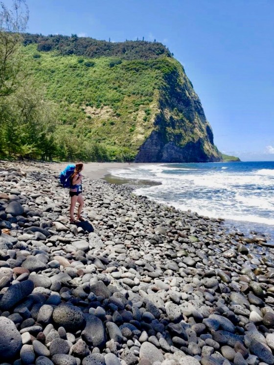
Even though rain began to accompany our trek as we were halfway down the steep valley wall, we couldn’t help but stop to take one last photo before we tucked our cameras away. Although most of the hillside was covered in thick foliage, which thankfully sheltered us from the majority of the rain, there was one area with a break in the foliage that provided the perfect, framed photo opp of the iconic, cascading Wai’ilikahi Falls that would later define the backdrop of our campsite views from the valley floor.
Side note – somewhere along this steep section of the trail, hubby and I both had very good cell phone and data reception with Verizon where we could check in quickly with our family and friends, but for the rest of the trail, we had absolutely no signal.


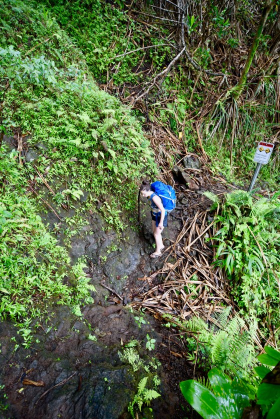
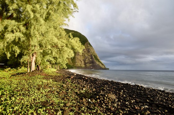
After scrambling through overgrown grasses as tall as our shoulders and cutting up our legs and feet with countless spiky palm leaves covering the trail, we finally reached the valley floor and rocky beach at 7:10 p.m. By this time, rain was pouring down and the sky was pitch dark. At the rocky beach, we immediately came to the second stream crossing and this one was going to be a bear to cross due to the constant, pouring rain.
Much like the first stream crossing in Waipi’o Valley, hubby was ready to boldly tread across it, but even in the darkness, we could both see that this river was flowing quite heavily and crossing it on foot with our packs was not an option because our packs would get soaked.
I had known from trail reports that crossing the stream closer to the beach was easier than crossing upstream, but the entire trail area we were standing on was covered in big rocks that were difficult to walk on, and in the darkness and rain, traveling further downstream and testing out the water depth there was not an option either.
We only had one option left; there was supposedly a boat or kayak that hikers could use to lay their packs on to get them across the stream dry. We quickly scanned the area in the darkness and finally noticed that the boat was located directly across from us on the wide stream.
While I proclaimed that we give up and just set up camp on the less-than-ideal rocky beach, my hero of husband immediately took off his pack and swam across the stream to retrieve the boat. Even with hubby being 6’2″, the water reached above his neck as he crossed the stream. I was glad it was him swimming in that dark, mysterious water and not me!
The boat ended up being just as sketchy as the dark stream it sat on. It was filled with water, not just from the day’s pouring rain, but also from the many holes and dents in it. It had surely seen better days probably decades ago and likely wasn’t sea-worthy enough to hold two people, much less, two additional heavy packs all at once, but doing two separate stream crossings was not an option at this point.
There was a rope that hung across the stream to help hikers get across, but pulling ourselves across the stream in the heavy, water-logged boat with the slimy, mossy rope was also no easy task, as the river flow wanted to pull us away from the rope downstream and knock the boat over.
I’ll admit that I had the biggest and most embarrassing panic attack of my life sitting in that boat with hubby, trying to get across the stream that night. I thought surely we were going to tip over and all of our belongings would fall to the bottom of that dark river.
From the river, we could see that two campers were outside in the rain and still awake with headlamps on at one of the first campsites, likely witnessing our entire crazy ordeal to get across the stream (and likely also wondering what idiots would arrive so late).
Eventually we made it safely across the stream, but our journey still wasn’t over yet!
There were nine campsites down the beach and we had reserved campsite #8, which we immediately began to regret as we made our way down the long, rocky path that each of the campsites branched off of. We only passed one other campsite that was occupied, but whose guests seemed to be peacefully inside their tent. The first four campsites were fairly close together along the beach, but after we passed the fifth campsite, we entered into an area more densely populated with trees where the campsites were more spread apart. Just when we began to wonder if we were even on the right path anymore, we stumbled upon our campsite, at last!
We set up our tent quickly and although I had done nothing but think about food and water almost our entire hike, by the time we had reached our campsite and set up our tent, which was 8:30 p.m. (!!!!!), I wanted nothing more than to get cozy and go to sleep!
Hubby, on the other hand, hastily left on a mission. We had both run out of water on our hike and hubby wanted to find the spring in the valley where we could get more water from (which still had to be filtered). Unfortunately, I had little information on where we could find the spring other than it being further down the beach and back into the valley, and hubby had even less knowledge!
Hubby ventured out anyway while I decided to open the bottle of wine I was sooo glad I had hauled in. Two cups of wine later, with the rain still pouring, hubby finally returned and, not surprisingly, he had been unsuccessful in finding the spring in the darkness. He had reached the end of the campsites and dead-ended at the steep valley wall, not knowing he would have to turn [left] into the valley… but even if he had known this information, it would still have been impossible to find at night (as we later learned).
Hubby decided to trek back to the first campsite by the stream, where we had seen campers still awake, and beg them for water. Fortunately, the campers did spare some water, but they also commented that they were hiking out early the next morning. I couldn’t help but feel really bad that we had likely taken precious water they would need for their hike out.
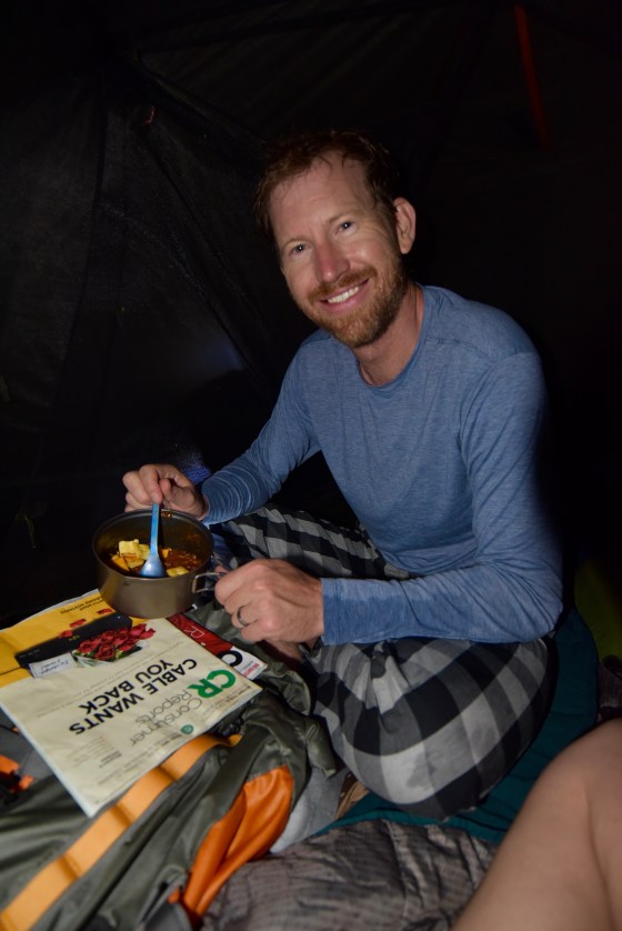
That night, we ate a quick meal of canned chili and fell asleep to rain still pouring on our tent. We were exhausted, but grateful we had made it safely with an enthralling story to tell of our adventure.
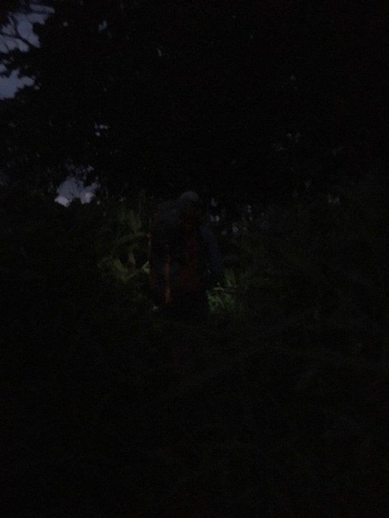
Nothing but absolute darkness when we finally arrived at the beach with the campsites. Can you make out the vague silhouette of hubby walking in front of me with a headlamp?
Day 2 >> August 20
Between the loud sounds of pouring rain on our tent and crashing waves on the beach, along with the temperature in our tent that seemed to fluctuate between two extremes of being either too hot under our camping blankets and too cold with just the thin sleeping bag liner, I hadn’t gotten much sleep that first night… but all of that hardly mattered. The next morning I woke up early and could not wait to get my first glimpse of the valley and the reason we hiked 11 miles the day before!
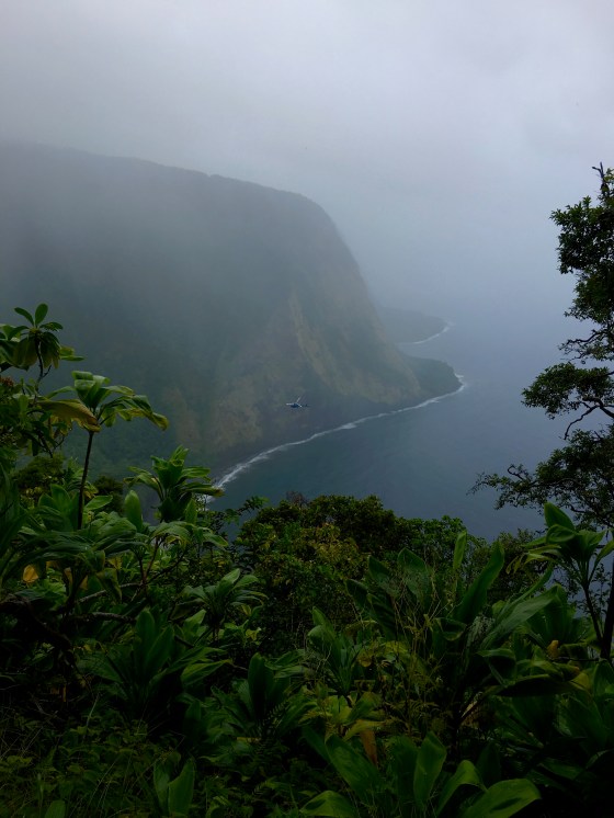
With the sun just barely beginning to rise over the ocean in the opposite direction of the valley and moody, foggy clouds still covering the tops of the valley walls, the scene was absolutely breathtaking!


For the first part of the early morning, I enjoyed walking solo around the beach and soaking in all the sights we had been unable to see in the darkness when we arrived. It wasn’t long before I noticed that I was physically paying the price for my exploration. Between the mosquito bites from the forested areas and skin irritation from overgrown grasses, my overly sensitive body was waving a white flag… but I couldn’t be stopped!
One of the sights I had been most curious to see was the stream we had crossed before reaching the campsites. In the daylight, the boat was just as sketchy as it had appeared at night, but I could confirm that we would not have been able to make it across any other way than that awful boat, since the stream was indeed high and strong.
The second sight I was eager to find/see was the spring. I ventured past the last campsite on the beach and turned into the valley thinking the spring would be obvious in the daylight, but it wasn’t! It turned out that the spring was actually somewhat far in the valley and there were little orange flags tied to the trees every so often that were crucial to guiding the way (mostly to get there via the easiest path). There was no way we could have found the spring so far back in the valley in the darkness the night before.


Baby piggies!

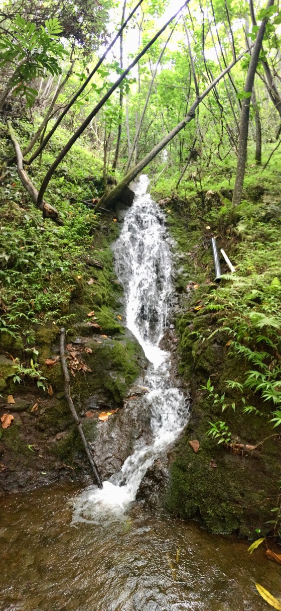
The stream with the spring where we got our water from.
And the third sight I was eager to see were all the different campsites. When we reserved our campsite permit a month in advance, I was a bit annoyed that we had to commit to one of the nine campsites, sight unseen, rather than get full descriptions with photos like an Airbnb (ridiculous, amiright?). The campsites ended up looking all about the same with short rock walls that had been built up to sit on and provide some shelter from wind and rain, and almost all of them also had fire pits.
The biggest difference between the campsites were that the first four campsites had great views of the valley and waterfalls, but didn’t have many tress for shade around them, while the last five campsites were nestled in the trees and spread apart, which meant they were more shaded and had a tiny bit more privacy, but no views of the valley.
The last few campsites were also closer to the spring in the valley, which was an important factor to consider since it was quite a trek to get to the spring. We ended up making four trips to the spring to get water for our full day in the valley, as well as planning ahead to filter water for our early morning hike out, so having a campsite closer to the spring was a big deal if we wanted to conserve energy…
But I cared more about having a great view than conserving energy… so that morning, I insisted we move from our cozy campsite #8 in the trees to campsite #3, which was unoccupied and had the most perfect view of the idyllic valley and coordinating waterfalls.

Campsite #1 – Probably the least cozy one and least private (since all the new campers coming in would pass right by or through it to get to their campsites). It also didn’t have much room for a tent.

Campsite #2 – Probably the best open views, but not shaded and very sandy ground to set up on.
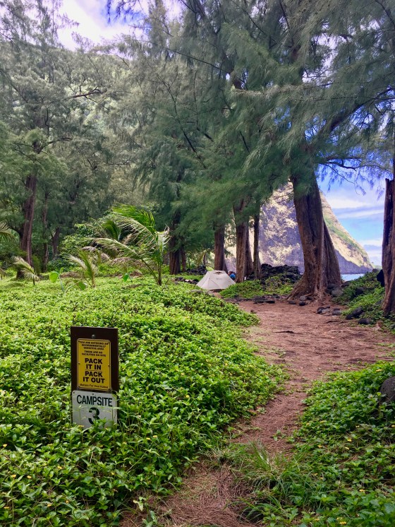
Campsite #3 – This one stretched across three different tent areas parallel and close to the beach. This was the one we moved to on our second day so we could have views of the valley and waterfalls. It was personally my favorite campsite of the nine.


Campsite #4 – This one had a camp pad to the right that wasn’t ideal due to the small space, uneven ground, and lack of shade, but to the left was another camp pad that was partly shaded with a separate cozy area for relaxing under the trees

Campsite #4 with our tent (we moved here temporarily before we set up at #3 for our second night)

Outhouses between campsite #4 and #5. These were FULL of spiders and (disappointingly) lots of items left behind by campers.

Campsite #5 – This one was a big campsite that had a little bit of everything because it was at the start of where the campsites became more shaded, but still had a nearby view of the waterfall.

Campsite #6 – Nothing to write home about here, but an okay campsite.

Campsite #7 – Again, nothing to write home about for this campsite. It was decent!

Campsite #8 – This was the campsite we had reserved and set up at the first night; it was actually a really nice campsite and had a wall surrounding it that was perfect for sitting on during the day and provided a little bit of privacy from other campers passing by. The camp pad is on the other side of the sign.

Campsite #8 from a different view with our tent on it

Campsite #9 – This campsite was cozy and next to the beach with two areas (one for the tent and one for sitting/relaxing). A lot of other online blogs claimed that squatters often live at this campsite. We saw a few items left behind at this campsite like a machete, fishing net, and fishing rod, but no squatters.

Campsite #9 from a different view
After relocating campsites, we had nothing to do all day except sit around and admire the incredible views… and we weren’t complaining!
I had read many trail reports that said hiking to the main waterfall in the valley, Wai‘ilikahi Falls (which was further past the spring), was “a must see”, but once we had done our arduous hike in, I somehow couldn’t fathom the thought of making a three-mile roundtrip trek out to that waterfall, even though we literally had nothing else to do for that entire day. Neither of us were sore the next day, but we were just overall exhausted, and in my mind, I justified that seeing the waterfalls up close was probably overrated, dangerous, and just overall not worth the extra effort.
Looking back, I do feel a bit of regret that we had hiked all that way and didn’t go just a few extra miles to visit the waterfalls in the valley, but in hindsight, it is also easy to forget how physically draining it was hiking in a valley that had overgrown vegetation, muddy trails, and vengeful mosquitoes.
Nonetheless, the waterfall views from afar kept us mesmerized and entertained all day and we could not have wanted for more in the moment.
It was also tempting to go swimming in the ocean, but the unofficial trailhead sign that warned us of “plenty sharks” stuck out in our minds. Furthermore, the waves that pounded the beach didn’t look very inviting, so we did a hard pass on ocean activities. We did see some other campers who merrily played in the ocean without “incident” though.
During the day, only two new sets of neighbors arrived, one of which had hauled in a machete and gifted us some fresh coconut that they had cracked open. It was the most wonderful treat… except we were total rookies and had absolutely no clue how to actually eat it. The coconut ended up being better for a fun photo opp than eating.
By mid-afternoon, I had begun anxiously counting down time until our imaginary “happy hour” when I could finally crack into my stash of wine that was tragically halfway depleted after our first night. It wasn’t until this point in the trip that hubby casually commented that I should have brought a bag of wine (from boxed wine) instead of a bottle of wine because not only would I have had more wine to consume on our trip, but I also would not have been stuck with an empty, heavy glass bottle after consuming all that wine. I was really upset at hubby for thinking of this brilliant idea while we were 11 miles deep in a desolate valley in Hawaii with only a few drops left of wine. Fortunately, hubby spared some of his whiskey and we had a fantastic afternoon happy hour.


Before we could retire for the night, we decided to visit the big stream one last time to see if there was any possibility that it would be easier to cross at the section that was closer to the ocean than having to use the boat again.
Even though the stream was still flowing fairly heavily, a log that was caught on some rocks near the mouth of the stream made the perfect obstruction for holding onto while crossing the knee-deep water. We were so upset that we hadn’t been able to cross with this “easy” method the night before, but at least we knew we would have an easier trek out the next morning.


Day 3 >> August 21
During our second night on the beach, the rain poured relentlessly yet again, while the waves on the beach crashed so violently that I had nightmares our tent was going to be swept out to the ocean at any moment.
The next morning, we both woke up to the most breath-taking views of overflowing falls that were, without a doubt, worth the loss of sleep. Not only were the waterfalls gleaming with all the rainfall, but a post-storm rainbow set the scene for the perfect send-off for our hike out.
Our blissful state-of-mind was a bit short-lived though. As we approached the stream in Waimanu Valley, we could see that the abundant rainfall had caused the stream to swell even more than it had the previous day, dislodging the log from the stream that we had optimistically depended on to cross.
We had to use the boat to cross again and, not surprisingly, it was located again on the other side, so one of us would have to retrieve it… and my turn was up! Although it was not pleasant crossing the dark stream, at least we were able to cross successfully without dumping our belongings in the swift stream!
After our first obstacle, the rest of our hike out seemed to go much more quickly and easily than the hike in, partially because we knew what to expect the second time around… that is, until we came to the second big stream crossing again. This one was even more of a pain to cross with the recent rains, but we eventually made it across safely and dry.
On our final ascent back up the steep Waipi’o Valley road, it should come as no shock that our luck continued and not a single vehicle passed us to give us a ride out. We rounded out our trip out that day with another 11 miles in the books, making for a total of 22 miles for the whole hike. Although our clothing was drenched from a day’s worth of rain, our were hearts full of incredible memories and we could not have asked for a better or more memorable experience on the Big Island.
Up Next: We finished our Big Island vacay with three days on the other side of the island in the town of Volcano.